Kimmeridge Road, Mottingham
Introduction
The photograph on this page of Kimmeridge Road, Mottingham by Malc McDonald as part of the Geograph project.
The Geograph project started in 2005 with the aim of publishing, organising and preserving representative images for every square kilometre of Great Britain, Ireland and the Isle of Man.

There are currently over 7.5m images from over 14,400 individuals and you can help contribute to the project by visiting https://www.geograph.org.uk
Kimmeridge Road, Mottingham
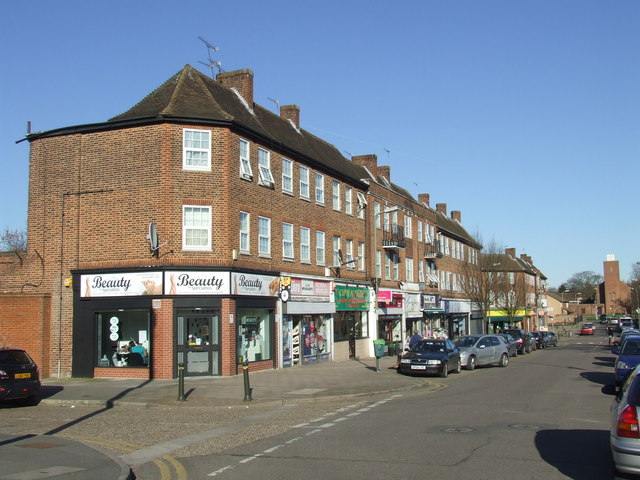
Image: © Malc McDonald Taken: 19 Mar 2011
The Mottingham Estate is a 2,000 home housing estate developed in the 1930s by the London County Council. As well as housing, the estate included facilities such as shops and a church, both visible in this image.
Images are licensed for reuse under creativecommons.org/licenses/by-sa/2.0
Image Location
Latitude
51.427173
Longitude
0.045154