IMAGES TAKEN NEAR TO
Leathwell Road, LONDON, SE8 4JL
Introduction
This page details the photographs taken nearby to Leathwell Road, SE8 4JL by members of the Geograph project.
The Geograph project started in 2005 with the aim of publishing, organising and preserving representative images for every square kilometre of Great Britain, Ireland and the Isle of Man.

There are currently over 7.5m images from over14,400 individuals and you can help contribute to the project by visiting https://www.geograph.org.uk
Image Map (Loading...)


Getting Data...Please wait
Leaflet Map data © OpenStreetMap
Images are licensed for reuse under creativecommons.org/licenses/by-sa/2.0
Notes
- Clicking on the map will re-center to the selected point.
- The higher the marker number, the further away the image location is from the centre of the postcode.
Image Listing (258 Images Found)
Images are licensed for reuse under creativecommons.org/licenses/by-sa/2.0
Image
Details
Distance
1
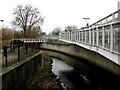
River Ravensbourne, near Elverson Road station
This is looking downstream. Although the Ravensbourne is the traditional boundary between Surrey and Kent, this boundary runs along the natural course of the river, somewhat west of here, so that all this bit is actually in Kent - that is, the real Kent before it started to be gobbled up by London!
Image: © Dr Neil Clifton
Taken: 20 Jan 2010
0.02 miles
3
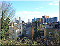
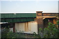
Houses & High Rise
At the south end of Brookmill Park is a large earth mound with steps up the side. From the top you get a view over nearby rooftops towards the high blocks in central Lewisham.
Image: © Des Blenkinsopp
Taken: 6 Mar 2020
0.04 miles
8
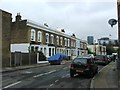
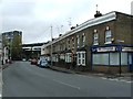
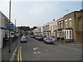
Brookmill Road
Looking south-east. Brookmill Road is not overly busy, but is in fact part of an A road, the A2210.
Image: © Dr Neil Clifton
Taken: 20 Jan 2010
0.06 miles
9
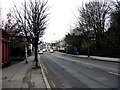
Elverson Road, Lewisham
This is a road that has got cut off by the DLR. Looking westwards from the 'dead' end. Note the signs and road markings for cycle route 21.
Image: © Stephen Craven
Taken: 19 Sep 2009
0.06 miles
10
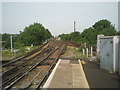
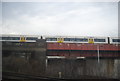
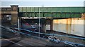
Looking up the line from Lewisham station
The original part of Lewisham station opened in 1849, on the North Kent Line which by-passed Greenwich because the Royal Observatory did not want their sensitive instruments disturbed by trains. This view looks up the line towards St Johns. The train on the left has come from Victoria and is crossing the flyover under which bypass lines miss out Lewisham station altogether. It was under this flyover where the Lewisham train disaster of 4th December 1957 happened when 90 passengers were killed in Britain's third worst rail disaster.
See https://www.youtube.com/watch?v=zB4as3sCn_Q for a newsreel from the time.
Image: © Marathon
Taken: 6 May 2011
0.06 miles