Looking up the line from Lewisham station
Introduction
The photograph on this page of Looking up the line from Lewisham station by Marathon as part of the Geograph project.
The Geograph project started in 2005 with the aim of publishing, organising and preserving representative images for every square kilometre of Great Britain, Ireland and the Isle of Man.

There are currently over 7.5m images from over 14,400 individuals and you can help contribute to the project by visiting https://www.geograph.org.uk
Looking up the line from Lewisham station
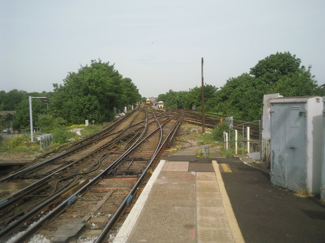
Image: © Marathon Taken: 6 May 2011
The original part of Lewisham station opened in 1849, on the North Kent Line which by-passed Greenwich because the Royal Observatory did not want their sensitive instruments disturbed by trains. This view looks up the line towards St Johns. The train on the left has come from Victoria and is crossing the flyover under which bypass lines miss out Lewisham station altogether. It was under this flyover where the Lewisham train disaster of 4th December 1957 happened when 90 passengers were killed in Britain's third worst rail disaster. See https://www.youtube.com/watch?v=zB4as3sCn_Q for a newsreel from the time.
Images are licensed for reuse under creativecommons.org/licenses/by-sa/2.0
Image Location
Latitude
51.467007
Longitude
-0.017423