IMAGES TAKEN NEAR TO
Rubens Street, LONDON, SE6 4DH
Introduction
This page details the photographs taken nearby to Rubens Street, SE6 4DH by members of the Geograph project.
The Geograph project started in 2005 with the aim of publishing, organising and preserving representative images for every square kilometre of Great Britain, Ireland and the Isle of Man.

There are currently over 7.5m images from over14,400 individuals and you can help contribute to the project by visiting https://www.geograph.org.uk
Image Map
Images are licensed for reuse under creativecommons.org/licenses/by-sa/2.0
Notes
- Clicking on the map will re-center to the selected point.
- The higher the marker number, the further away the image location is from the centre of the postcode.
Image Listing (81 Images Found)
Images are licensed for reuse under creativecommons.org/licenses/by-sa/2.0
Image
Details
Distance
3
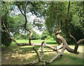
Down But Not Out
Most trees give up when they get blown over, but not Willows.
This one in the Pool River Linear Park is still growing vigorously from a horizontal position.
Image: © Des Blenkinsopp
Taken: 9 Aug 2016
0.13 miles
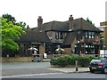
5
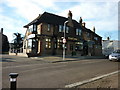
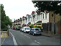
The Perry Hill public house on Perry Hill, Lewisham
Image: © Ian S
Taken: 9 Dec 2010
0.14 miles
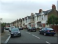
7
Path to Winsford Road
Following the line of Broadmead and the railway footbridge as it crosses the Pool River and its linear park, and re-enters housing on Winsford Road.
Image: © Derek Harper
Taken: 9 May 2013
0.14 miles
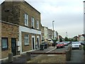
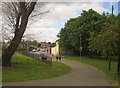
9
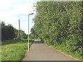
Waterlink Way at Bellingham
One of the most secluded sections of the Waterlink Way alongside the railway at Bellingham. Although it is lit, I would not be confident walking/cycling along here after dark.
Image: © Stephen Craven
Taken: 8 Jun 2008
0.15 miles
10
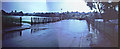
Pool River in Flood - 1968
Picture taken from the end of Winsford Road shows the area inundated by the floods of 16th September 1968. Not a very good photo as taken in conditions of exceptionally heavy rain and then scanned from two old slides to make panorama but of some historical and hydrological interest. Compare this with the peaceful stream shown in Image As a result of the flood the allotments situated just out of shot to the left of the picture received liberal deposits of coke washed down from the Bell Green Gasworks Image This flood in SE England was the worst in many years.
Image: © David Wright
Taken: 16 Sep 1968
0.15 miles