IMAGES TAKEN NEAR TO
Meadowview Road, LONDON, SE6 3NH
Introduction
This page details the photographs taken nearby to Meadowview Road, SE6 3NH by members of the Geograph project.
The Geograph project started in 2005 with the aim of publishing, organising and preserving representative images for every square kilometre of Great Britain, Ireland and the Isle of Man.

There are currently over 7.5m images from over14,400 individuals and you can help contribute to the project by visiting https://www.geograph.org.uk
Image Map
Images are licensed for reuse under creativecommons.org/licenses/by-sa/2.0
Notes
- Clicking on the map will re-center to the selected point.
- The higher the marker number, the further away the image location is from the centre of the postcode.
Image Listing (105 Images Found)
Images are licensed for reuse under creativecommons.org/licenses/by-sa/2.0
Image
Details
Distance
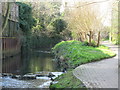
1
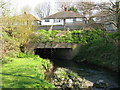
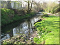
The Pool River south of Meadowview Road, SE6
Image: © Mike Quinn
Taken: 9 Apr 2010
0.02 miles
2
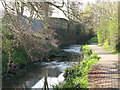
The Pool River south of Meadowview Road, SE6 (4)
Image: © Mike Quinn
Taken: 9 Apr 2010
0.02 miles
3
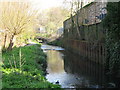
The Pool River south of Meadowview Road, SE6 (6)
Image: © Mike Quinn
Taken: 9 Apr 2010
0.02 miles
4
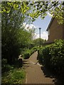
Paths, Lower Sydenham
Between houses on Montana Gardens and Pool River, off to the left.
Image: © Derek Harper
Taken: 9 May 2013
0.03 miles
5
The Pool River south of Meadowview Road, SE6 (3)
Image: © Mike Quinn
Taken: 9 Apr 2010
0.04 miles
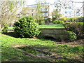
6
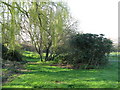
Southend Park
This area, south of the Image, appears to be the lowest part of the park and therefore probably the course of the Pool River.
Image: © Mike Quinn
Taken: 9 Apr 2010
0.05 miles
8
The Pool River south of Meadowview Road, SE6 (2)
Image: © Mike Quinn
Taken: 9 Apr 2010
0.05 miles
9
The Pool River south of Meadowview Road, SE6 (5)
Image: © Mike Quinn
Taken: 9 Apr 2010
0.07 miles
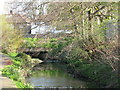
10
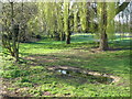
Bridge in Southend Park
I can't be sure, but I think that this bridge marks where the Pool River used to enter its passage under the buildings on the south side of Southend Lane, emerging at Image I think that the river is now diverted in a culvert along the western edge of the park.
Image: © Mike Quinn
Taken: 9 Apr 2010
0.07 miles