IMAGES TAKEN NEAR TO
Mountfield Close, LONDON, SE6 1AF
Introduction
This page details the photographs taken nearby to Mountfield Close, SE6 1AF by members of the Geograph project.
The Geograph project started in 2005 with the aim of publishing, organising and preserving representative images for every square kilometre of Great Britain, Ireland and the Isle of Man.

There are currently over 7.5m images from over14,400 individuals and you can help contribute to the project by visiting https://www.geograph.org.uk
Image Map
Images are licensed for reuse under creativecommons.org/licenses/by-sa/2.0
Notes
- Clicking on the map will re-center to the selected point.
- The higher the marker number, the further away the image location is from the centre of the postcode.
Image Listing (34 Images Found)
Images are licensed for reuse under creativecommons.org/licenses/by-sa/2.0
Image
Details
Distance
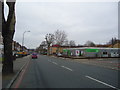
2
Shops on the South Circular
This is a Parade of shops on Brownhills road to the east of Catford on the south circular road.
Image: © Glyn Baker
Taken: 6 Sep 2005
0.08 miles
4
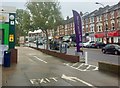
Brownhill Road
View across the A205 from the petrol station.
Image: © Alan Hughes
Taken: 4 Nov 2019
0.10 miles
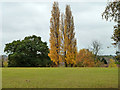
5
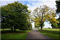
Trees beginning to turn in Mountsfield Park
Image: © Bill Boaden
Taken: 11 Oct 2014
0.10 miles
7
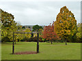
Exercise apparatus, Mountsfield Park
Looking rather like a gibbet for six unfortunates.
Image: © Robin Webster
Taken: 30 Oct 2011
0.12 miles
8
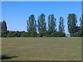
Mountsfield Park
A short slope runs north south through the centre of Mountsfield Park. This view is from the top of the slope looking to the lower, western half. Sydenham is in the far distance.
Image: © Marathon
Taken: 24 Aug 2010
0.13 miles
9
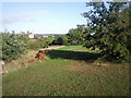
Mountsfield Park
A fairly steep slope runs north south through the centre of Mountsfield Park. The west side of the park is lower than the east. Shrubs and trees lie along much of the slope as seen to the left of the rotting log. The wooded hill on the horizon to the right of the tower block is Nunhead Cemetery.
Image: © Marathon
Taken: 24 Aug 2010
0.13 miles
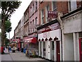
10
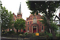
Lewisham: Brownhill Road Baptist Church
Image: © Dr Neil Clifton
Taken: 29 Aug 2012
0.14 miles