1
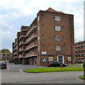
Landor House, Camberwell
Looking southeast to blocks of former council flats, named after poets and believed to have been built in the 1950s. An OS map of the period shows a largely vacant site with Landor House built, and some remaining shops on Camberwell Road. Kipling House, behind the camera, incorporates a parade of shops.
A rather different Landor House is http://www.geograph.org.uk/photo/3475560
Image: © Robin Stott
Taken: 25 Aug 2013
0.00 miles
2
Landor House flats, Camberwell
An OS map of 1951-2 shows Landor House as the first of these monumental blocks to be built by the London County Council in this part of Camberwell. The rear of the block is seen in
Image The name refers to the poet Walter Savage Landor, 1775-1864.
Image: © Robin Stott
Taken: 18 Sep 2015
0.01 miles
3
Lamb House, Camberwell, with Landor House behind
Looking south to blocks of former council flats, named after poets and believed to have been built in the 1950s. An OS map of the period shows a largely vacant site with Landor House, left, built, and some remaining shops on Camberwell Road. Kipling House, behind the camera, incorporates a parade of shops.
Note the low wall and rail: it robustly marks a boundary but does not exclude anyone visually or physically.
Image: © Robin Stott
Taken: 25 Aug 2013
0.03 miles
4
Rear of Marvell House flats, Camberwell
One of the post-war blocks in Camberwell named after poets.
Image: © Robin Stott
Taken: 18 Sep 2015
0.03 miles
5
Marvell House, Camberwell
Looking northeast to blocks of former council flats, named after poets and believed to have been built in the 1950s. An OS map of the period shows a largely vacant site with Landor House, out of shot right, built, and some remaining shops on Camberwell Road. Kipling House, out of shot left, incorporates a parade of shops. Milton House in the distance.
Stephen Richards adds: built 1956 by the London County Council. Further information about municipal housing of the period would be very welcome.
Image: © Robin Stott
Taken: 25 Aug 2013
0.03 miles
6
South end of Kipling House, Camberwell
Kipling House is a parade of shops with flats above facing Camberwell Road. Built in the early 1950s by London County Council, it replaced a number of small shops that may have suffered bomb damage. On the left, Castlemead. On the right, Marvell House
Image Early evening.
Image: © Robin Stott
Taken: 18 Sep 2015
0.03 miles
7
Open space between Landor House and Lamb House, Camberwell
Landor House, the first of the estate to be built, is on the left. It was built by the London County Council in the early 1950s. The generous space between the blocks helps to reduce any feeling of oppressiveness. Early evening.
Image: © Robin Stott
Taken: 18 Sep 2015
0.04 miles
8
Kipling House and Marvell House, Camberwell
Looking north to blocks of former council flats, named after poets and believed to have been built in the 1950s. An OS map of the period shows a largely vacant site with Landor House, out of shot right, built, and some remaining shops on Camberwell Road. Kipling House, left, incorporates a parade of shops.
Note the low wall and rail: it robustly marks a boundary but does not exclude anyone visually or physically.
Image: © Robin Stott
Taken: 25 Aug 2013
0.04 miles
9
Empty Flecker House behind Broome Way, Camberwell
A block of 12 flats empty and locked. On the left is the end of the Broome Way flats
Image On the right is the rear of post-war Marvell House flats.
Image: © Robin Stott
Taken: 18 Sep 2015
0.04 miles
10
Rear of empty Flecker House, off Broome Way, Camberwell
The reference is to James Elroy Flecker, 1884-1915, author of Hassan and "rich verse". This is one of the blocks of flats in Camberwell named after poets. On the right is the rear of the maisonettes at 30-72 Lomond Grove
Image Multi-storey Masterman House pokes its head above the roofline.
Image: © Robin Stott
Taken: 18 Sep 2015
0.04 miles


