Lamb House, Camberwell, with Landor House behind
Introduction
The photograph on this page of Lamb House, Camberwell, with Landor House behind by Robin Stott as part of the Geograph project.
The Geograph project started in 2005 with the aim of publishing, organising and preserving representative images for every square kilometre of Great Britain, Ireland and the Isle of Man.

There are currently over 7.5m images from over 14,400 individuals and you can help contribute to the project by visiting https://www.geograph.org.uk
Lamb House, Camberwell, with Landor House behind
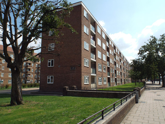
Image: © Robin Stott Taken: 25 Aug 2013
Looking south to blocks of former council flats, named after poets and believed to have been built in the 1950s. An OS map of the period shows a largely vacant site with Landor House, left, built, and some remaining shops on Camberwell Road. Kipling House, behind the camera, incorporates a parade of shops. Note the low wall and rail: it robustly marks a boundary but does not exclude anyone visually or physically.
Images are licensed for reuse under creativecommons.org/licenses/by-sa/2.0
Image Location
Latitude
51.476903
Longitude
-0.093605