IMAGES TAKEN NEAR TO
Tudway Road, LONDON, SE3 9YX
Introduction
This page details the photographs taken nearby to Tudway Road, SE3 9YX by members of the Geograph project.
The Geograph project started in 2005 with the aim of publishing, organising and preserving representative images for every square kilometre of Great Britain, Ireland and the Isle of Man.

There are currently over 7.5m images from over14,400 individuals and you can help contribute to the project by visiting https://www.geograph.org.uk
Image Map
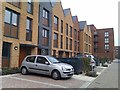
Images are licensed for reuse under creativecommons.org/licenses/by-sa/2.0
Notes
- Clicking on the map will re-center to the selected point.
- The higher the marker number, the further away the image location is from the centre of the postcode.
Image Listing (114 Images Found)
Images are licensed for reuse under creativecommons.org/licenses/by-sa/2.0
Image
Details
Distance
1
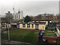
Primary School
Holy Family Catholic Primary School, Kidbrooke.
Image: © Alan Hughes
Taken: 20 Jan 2018
0.02 miles
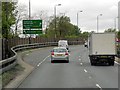
3

Stainer House, Ferrier Estate
A 12-floor block on Ryan Close on the Ferrier Estate - see Image, which shows the building on the left. This block forms part of the second, 1970s, phase of the estate. Beyond is Felton House. The low building on the immediate right is the Holy Family Catholic Primary School.
Image: © Derek Harper
Taken: 20 May 2006
0.04 miles
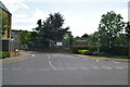
5
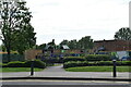
And in with the new...
New housing on the Kidbrooke Village development. For a sense of what was here before, see Image
Image: © David Martin
Taken: 22 Mar 2013
0.05 miles
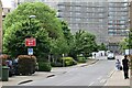
7
Kidbrooke Village: Park Terrace
A long row of contemporary town houses, seen across an as yet undeveloped part of the site.
It is difficult to compare old photos with new in this estate with great precision, as the whole area is being completely transformed, but the Sainsbury's Local store to the left of the photo is roughly in the area seen in Image two-and-a-half years earlier.
Image: © Stephen Craven
Taken: 24 Jan 2015
0.07 miles
8
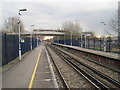
View south east of Kidbrooke railway station
Looking towards Eltham
Image: © Nigel Thompson
Taken: 14 Mar 2013
0.08 miles
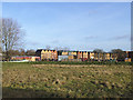
9
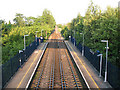
Railway east of Kidbrooke
A view from the footbridge over Kidbrooke station, looking towards Eltham. The railway was built long before the area was developed for housing and runs dead straight for 2km between Blackheath Junction and Eltham.
Image: © Stephen Craven
Taken: 20 Jun 2010
0.08 miles