IMAGES TAKEN NEAR TO
Wricklemarsh Road, LONDON, SE3 8ES
Introduction
This page details the photographs taken nearby to Wricklemarsh Road, SE3 8ES by members of the Geograph project.
The Geograph project started in 2005 with the aim of publishing, organising and preserving representative images for every square kilometre of Great Britain, Ireland and the Isle of Man.

There are currently over 7.5m images from over14,400 individuals and you can help contribute to the project by visiting https://www.geograph.org.uk
Image Map
Images are licensed for reuse under creativecommons.org/licenses/by-sa/2.0
Notes
- Clicking on the map will re-center to the selected point.
- The higher the marker number, the further away the image location is from the centre of the postcode.
Image Listing (58 Images Found)
Images are licensed for reuse under creativecommons.org/licenses/by-sa/2.0
Image
Details
Distance
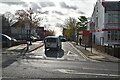
1
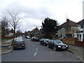
Bus stop on Corelli Road, Kidbrooke
The bus stop in the photo is served by route 386.
Image: © Stephen Craven
Taken: 16 Feb 2014
0.05 miles
3
Entrance to Corelli College, Kidbrooke
The school itself Image is, like most schools nowadays, surrounded by security fences.
Image: © Stephen Craven
Taken: 16 Feb 2014
0.11 miles
4
Corelli College, Kidbrooke
This secondary school on Corelli Road was Kidbrooke School.
Now converted into the First London Co-operative Academy.
Image: © David Anstiss
Taken: 11 Sep 2011
0.12 miles
7
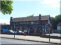
Shooters Hill Road's Co-op
The former Brook Hotel public house.
Image: © JThomas
Taken: 20 Jun 2022
0.14 miles
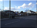
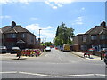
8
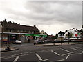
Shooter's Hill Co-operative Supermarket
On junction of the A207 Shooter's Hill Road (on the right) and Corelli Road (behind the shop).
This used to be the Brook Public House (after the nearby hospital - now demolished), In the 19th Century, it was called the Earl of Moira.
Image: © David Anstiss
Taken: 11 Sep 2011
0.15 miles
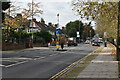
10
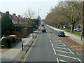
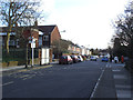
Shooters Hill Road, A207
Along the route of the Roman Watling Street, not quite as straight here now as further back.
Image: © Robin Webster
Taken: 14 Mar 2012
0.15 miles