IMAGES TAKEN NEAR TO
Templar Drive, LONDON, SE28 8PH
Introduction
This page details the photographs taken nearby to Templar Drive, SE28 8PH by members of the Geograph project.
The Geograph project started in 2005 with the aim of publishing, organising and preserving representative images for every square kilometre of Great Britain, Ireland and the Isle of Man.

There are currently over 7.5m images from over14,400 individuals and you can help contribute to the project by visiting https://www.geograph.org.uk
Image Map
Images are licensed for reuse under creativecommons.org/licenses/by-sa/2.0
Notes
- Clicking on the map will re-center to the selected point.
- The higher the marker number, the further away the image location is from the centre of the postcode.
Image Listing (30 Images Found)
Images are licensed for reuse under creativecommons.org/licenses/by-sa/2.0
Image
Details
Distance
1
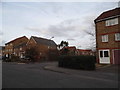
Summerton Way looking towards Turnbury Close
Image: © David Howard
Taken: 23 Feb 2014
0.07 miles
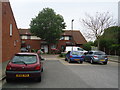
2
Turnbury Close, Thamesmead
Turnbury Road is a residential cul-de-sac in Thamesmead, in south east London.
Image: © Malc McDonald
Taken: 30 Dec 2017
0.08 miles
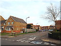
3
Roundabout on Crossway, Thamesmead
At the junction with Summerton Way
Image: © David Howard
Taken: 23 Feb 2014
0.09 miles
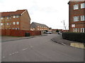
4
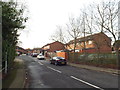
Wroxham Road, Thamesmead
Wroxham Road, in Thamesmead.
Image: © Malc McDonald
Taken: 30 Dec 2017
0.13 miles
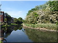
5
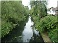
Waterway, Thamesmead
Part of an extensive drainage system, much of which has been incorporated into linear parks.
Image: © Robin Webster
Taken: 25 Jun 2011
0.14 miles
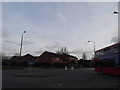
6
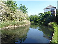
The lake at Crossway Park, Thamesmead
This is near the end of Watersmeet Way and is part of the Thamesmead Ecology Study Area. The island on the other side is not accessible. See https://londongardenstrust.org/inventory/gardens-online-record.php?ID=BEX012 for more information.
Image: © Marathon
Taken: 8 May 2020
0.14 miles
7
Redbourne Drive at the junction of Fairway Drive
Image: © David Howard
Taken: 23 Feb 2014
0.15 miles
8
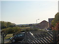
View of the hills above the houses in Lytham Close #2
Looking south-southwest.
Image: © Robert Lamb
Taken: 23 Oct 2011
0.15 miles
10
The lake at Crossway Park, Thamesmead
This is near the end of Watersmeet Way and is part of the Thamesmead Ecology Study Area. The island on the other side is not accessible. See https://londongardenstrust.org/inventory/gardens-online-record.php?ID=BEX012 for more information.
Image: © Marathon
Taken: 8 May 2020
0.16 miles