IMAGES TAKEN NEAR TO
Haverley Street, SE26 5FT
Introduction
This page details the photographs taken nearby to Haverley Street, SE26 5FT by members of the Geograph project.
The Geograph project started in 2005 with the aim of publishing, organising and preserving representative images for every square kilometre of Great Britain, Ireland and the Isle of Man.

There are currently over 7.5m images from over14,400 individuals and you can help contribute to the project by visiting https://www.geograph.org.uk
Image Map
Images are licensed for reuse under creativecommons.org/licenses/by-sa/2.0
Notes
- Clicking on the map will re-center to the selected point.
- The higher the marker number, the further away the image location is from the centre of the postcode.
Image Listing (87 Images Found)
Images are licensed for reuse under creativecommons.org/licenses/by-sa/2.0
Image
Details
Distance
2
Goal!!!
Photo taken with the kind permission of the Manager of Image
Image: © Mike Quinn
Taken: 9 Apr 2010
0.02 miles
3
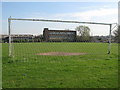
Sports ground south of Worsley Bridge Road, SE6
The course of the Pool River runs through the trees on the right hand (east) side of the sports ground.
Image: © Mike Quinn
Taken: 9 Apr 2010
0.02 miles
4
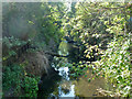
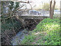
Pool River from Worsley Bridge
Looking upstream.
Image: © Robin Webster
Taken: 1 Oct 2011
0.03 miles
5
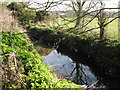
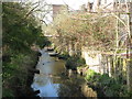
The Pool River
Photo taken with the kind permission of the Manager of Image
Image: © Mike Quinn
Taken: 9 Apr 2010
0.03 miles
6
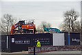
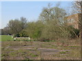
End of the Maybery Works
A small factory unit from before WW2 is now making way for housing.
Image: © Glyn Baker
Taken: 27 Mar 2019
0.03 miles
7
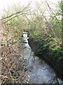
The Pool River
Photo taken with the kind permission of the Manager of Image
Image: © Mike Quinn
Taken: 9 Apr 2010
0.04 miles
8
The Pool River north of Worsley Bridge Road, SE6
Image: © Mike Quinn
Taken: 9 Apr 2010
0.05 miles
9
Worsley Bridge
Carrying Worsley Bridge Road SE6 over the Pool River.
Image: © Mike Quinn
Taken: 9 Apr 2010
0.05 miles
10
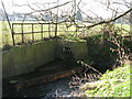
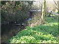
The Pool River
On the far bank is a drain from the sports ground west of Copers Cope Road. Photo taken with the kind permission of the Manager of Image
Image: © Mike Quinn
Taken: 9 Apr 2010
0.05 miles