IMAGES TAKEN NEAR TO
Holmesdale Road, LONDON, SE25 6JH
Introduction
This page details the photographs taken nearby to Holmesdale Road, SE25 6JH by members of the Geograph project.
The Geograph project started in 2005 with the aim of publishing, organising and preserving representative images for every square kilometre of Great Britain, Ireland and the Isle of Man.

There are currently over 7.5m images from over14,400 individuals and you can help contribute to the project by visiting https://www.geograph.org.uk
Image Map
Images are licensed for reuse under creativecommons.org/licenses/by-sa/2.0
Notes
- Clicking on the map will re-center to the selected point.
- The higher the marker number, the further away the image location is from the centre of the postcode.
Image Listing (117 Images Found)
Images are licensed for reuse under creativecommons.org/licenses/by-sa/2.0
Image
Details
Distance
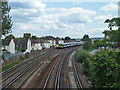
1
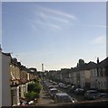
Holmesdale Road and Selhurst Park
From the train between Thornton Heath and Selhurst stations, a long vista opens up along Holmesdale Road with Selhurst Park, home of Crystal Palace FC, in the distance (specifically, and unsurprisingly, the Holmesdale End).
Image: © Christopher Hilton
Taken: 6 Aug 2010
0.01 miles
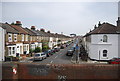
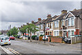
3
End houses, Holmesdale Road, Selhurst
Image: © Robin Webster
Taken: 19 Apr 2019
0.05 miles
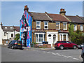
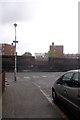
4
Hurlstone Road, Selhurst
Looking from the Newhaven Road end.
Image: © Robin Webster
Taken: 19 Apr 2019
0.06 miles
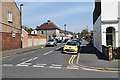
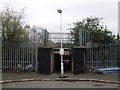
5
Railway towards Selhurst station
And onwards to East Croydon and points south.
Image: © Robin Webster
Taken: 29 Jun 2011
0.07 miles
6
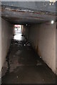
Subway under railway line, between Thornton Heath and Selhurst
The subway links two sections of Holmesdale Road.
Image: © Christopher Hilton
Taken: 24 May 2013
0.08 miles
7
Subway under railway line, between Thornton Heath and Selhurst
The subway links two sections of Holmesdale Road; seen here from the northern section.
Image: © Christopher Hilton
Taken: 24 May 2013
0.08 miles
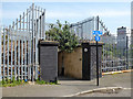
8
Subway under the railway, Selhurst
It links between two parts of Holmesdale Road.
It passes under the railway between Thornton Heath and Selhurst.
Image: © David Anstiss
Taken: 30 Oct 2011
0.08 miles
9
Railway bridge VTB1 54, Selhurst
A subway from the southern part of Holmesdale Road to Newhaven Road and the northern part of Holmesdale Road.
Image: © Robin Webster
Taken: 19 Apr 2019
0.08 miles
10
Charnwood Road
Houses on Charnwood Road. The road itself is marked on the 1896 1:1056 map but without development; although most of the road is then shown with houses on the 1913 25" map, the ones here are not shown until the 1934 edition.
Image: © Ian Capper
Taken: 6 Jul 2024
0.11 miles