1
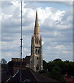
Forest Hill : Christ Church : view from Horniman Gardens.
The tower and spire of the church was built in 1885. Architect: Ewan Christian.
Image: © Jim Osley
Taken: 4 Aug 2018
0.08 miles
2
Flats from the train, Forest Hill
Image: © Christopher Hilton
Taken: 5 Feb 2013
0.09 miles
3
View from the train approaching Forest Hill station
In the distance the spire of Christ Church Forest Hill.
Image: © Christopher Hilton
Taken: 5 Feb 2013
0.10 miles
4
Christ Church, Forest Hill SE23
This view was from the footbridge at Forest Hill station. A grade 2 listed building, it was begun in 1852 and consecrated in 1854. The spire was completed in 1885. The church was declared redundant in July 2003 and was due to be converted into residential accommodation with a small place of worship created in the chancel.
Image: © Philip Talmage
Taken: 26 Aug 2005
0.11 miles
5
Hamilton Hall, South Road, SE23
The Forest Hill Christadelphians meet here.
Image: © Mike Quinn
Taken: 4 Jul 2008
0.12 miles
6
St Antholin's church spire, Sydenham SE26
St. Antholin’s, completed in 1688 and regarded as one of Wren’s finest City churches, stood on the corner of Sise Lane and Budge Row/Watling Street, roughly on the site now occupied by the Temple of Mithras, before the building of Queen Victoria Street. St. Antholin (a corruption of St. Anthony) was dedicated to St. Anthony of Egypt. The spire (one of Wren’s few true spires and the only stone one) was octagonal. St. Antholin’s was demolished in 1875. However, in 1829, the upper part of the spire had been replaced and the portion taken down sold for £5 to Robert Harrild, a printer, who had it erected on his property, Round Hill House in Sydenham. And here it stands, now surrounded by a cul-de-sac of modern town houses.
Image: © Philip Talmage
Taken: 21 Aug 2005
0.12 miles
7
Forest Hill Summer 1989
Looking up the South Circular from the junction with Dartmouth Road.Day and Month uncertain.
Image: © David Wright
Taken: Unknown
0.12 miles
8
Forest Hill - Summer 1989
Looking along the South Circular to junction with Devonshire Road.Day and Month uncertain.
Image: © David Wright
Taken: Unknown
0.12 miles
9
Bampton Road, Forest Hill
Bampton Road in Forest Hill, on a sunny day in early October. Leaves on the trees are starting to turn autumnal gold.
Image: © Malc McDonald
Taken: 4 Oct 2015
0.12 miles
10
Christ Church, Forest Hill: converted nave
The nave of this 1852-built grade 2 listed church (list entry number 1193968) has been converted to apartments. See
Image for the whole building in context.
Image: © Stephen Craven
Taken: 23 Mar 2014
0.12 miles


