St Antholin's church spire, Sydenham SE26
Introduction
The photograph on this page of St Antholin's church spire, Sydenham SE26 by Philip Talmage as part of the Geograph project.
The Geograph project started in 2005 with the aim of publishing, organising and preserving representative images for every square kilometre of Great Britain, Ireland and the Isle of Man.

There are currently over 7.5m images from over 14,400 individuals and you can help contribute to the project by visiting https://www.geograph.org.uk
St Antholin's church spire, Sydenham SE26
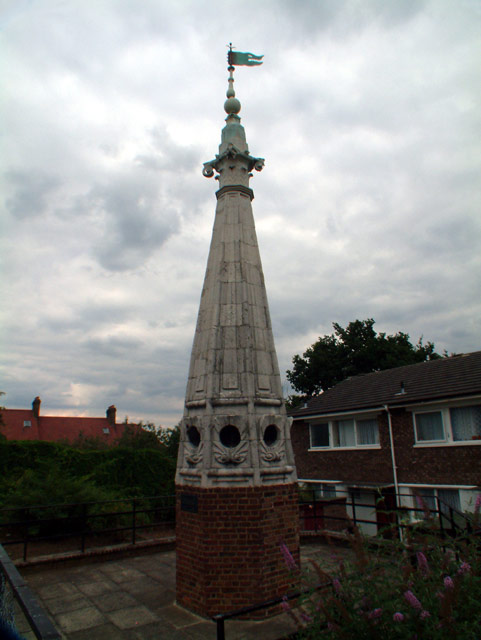
Image: © Philip Talmage Taken: 21 Aug 2005
St. Antholin’s, completed in 1688 and regarded as one of Wren’s finest City churches, stood on the corner of Sise Lane and Budge Row/Watling Street, roughly on the site now occupied by the Temple of Mithras, before the building of Queen Victoria Street. St. Antholin (a corruption of St. Anthony) was dedicated to St. Anthony of Egypt. The spire (one of Wren’s few true spires and the only stone one) was octagonal. St. Antholin’s was demolished in 1875. However, in 1829, the upper part of the spire had been replaced and the portion taken down sold for £5 to Robert Harrild, a printer, who had it erected on his property, Round Hill House in Sydenham. And here it stands, now surrounded by a cul-de-sac of modern town houses.
Images are licensed for reuse under creativecommons.org/licenses/by-sa/2.0
Image Location
Latitude
51.435303
Longitude
-0.052031