IMAGES TAKEN NEAR TO
Deventer Crescent, LONDON, SE22 8TJ
Introduction
This page details the photographs taken nearby to Deventer Crescent, SE22 8TJ by members of the Geograph project.
The Geograph project started in 2005 with the aim of publishing, organising and preserving representative images for every square kilometre of Great Britain, Ireland and the Isle of Man.

There are currently over 7.5m images from over14,400 individuals and you can help contribute to the project by visiting https://www.geograph.org.uk
Image Map
Images are licensed for reuse under creativecommons.org/licenses/by-sa/2.0
Notes
- Clicking on the map will re-center to the selected point.
- The higher the marker number, the further away the image location is from the centre of the postcode.
Image Listing (65 Images Found)
Images are licensed for reuse under creativecommons.org/licenses/by-sa/2.0
Image
Details
Distance
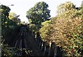
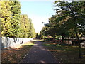
1
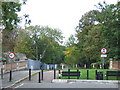
Greendale, SE22
Greendale, a shared walking and cycling path in East Dulwich. The bridge in the foreground takes the path over a railway line.
Image: © Malc McDonald
Taken: 17 Oct 2010
0.04 miles
2
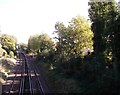
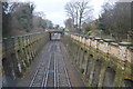
Railway to East Dulwich
As seen from Image
This line leads from Tulse Hill (via North Dulwich) towards East Dulwich and Peckham Rye.
Image: © David Anstiss
Taken: 2 Oct 2011
0.04 miles
4
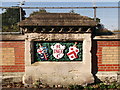
Crest on Greendale railway Bridge
One of the three decorated columns on the footbridge over the railway.
See Image
Image: © David Anstiss
Taken: 2 Oct 2011
0.05 miles
5
Railway to East Dulwich
As seen from Image
This line leads from Peckham Rye (via East Dulwich) towards
Tulse Hill (via North Dulwich).
In the background is Red Post Hill road bridge.
Image: © David Anstiss
Taken: 2 Oct 2011
0.06 miles
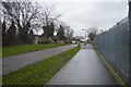
7
Greendale
This footpath and cyclepath leads from East Dulwich Road up towards Blanchedowne (road) near Denmark Hill .
Also used by National Cycle Route 23.
On the right is a sports pavilion of Dulwich High school.
Image: © David Anstiss
Taken: 2 Oct 2011
0.07 miles
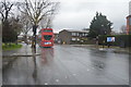
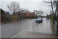
10
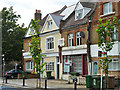
Former shops, East Dulwich Grove, SE22
Converted to housing, except one which seems to have closed down. Later views show this was converted too. The first floor stone has the date 1886.
Image: © Robin Webster
Taken: 23 Jul 2011
0.09 miles