IMAGES TAKEN NEAR TO
Ilkley Close, LONDON, SE19 3SQ
Introduction
This page details the photographs taken nearby to Ilkley Close, SE19 3SQ by members of the Geograph project.
The Geograph project started in 2005 with the aim of publishing, organising and preserving representative images for every square kilometre of Great Britain, Ireland and the Isle of Man.

There are currently over 7.5m images from over14,400 individuals and you can help contribute to the project by visiting https://www.geograph.org.uk
Image Map
Images are licensed for reuse under creativecommons.org/licenses/by-sa/2.0
Notes
- Clicking on the map will re-center to the selected point.
- The higher the marker number, the further away the image location is from the centre of the postcode.
Image Listing (111 Images Found)
Images are licensed for reuse under creativecommons.org/licenses/by-sa/2.0
Image
Details
Distance
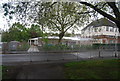
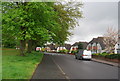
5
Upper Norwood Recreation Ground
Taken from the Capital Ring path. The block of flats a little to the left of centre marks the site of the former church of St Margaret, declared redundant in 2003 and subsequently demolished: the church can be seen in Image
Image: © Christopher Hilton
Taken: 28 Mar 2016
0.06 miles
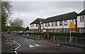
6
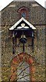
Bell and canopy, St Margaret's Church, Upper Norwood
The church dates from 1901, but was declared redundant on 6 January 2003. For more visit http://www.southwark.anglican.org/downloads/lostchurches/UPP01.pdf
Image: © Jim Osley
Taken: 25 Mar 2011
0.07 miles
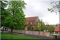
7
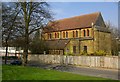
Redundant church, Upper Norwood
The church dates from 1901, but was declared redundant on 6 January 2003. For more visit http://www.southwark.anglican.org/downloads/lostchurches/UPP01.pdf
Image: © Jim Osley
Taken: 25 Mar 2011
0.07 miles
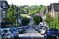
8
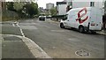
Orleans Road, SE19
Orleans Road here runs along the floor of a dip that marks the line of the River Effra, one of London's "lost" (largely-culverted) rivers, which rises here and flows to the Thames at Vauxhall. From the manhole cover close to the camera comes a constant sound of running water, presumably from the culverted stream below.
Image: © Christopher Hilton
Taken: 21 Apr 2016
0.07 miles
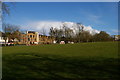
9
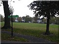
Upper Norwood Recreation Ground and Capital Ring sign
Image: © Christopher Hilton
Taken: 7 Oct 2007
0.09 miles