IMAGES TAKEN NEAR TO
Crown Dale, LONDON, SE19 3BH
Introduction
This page details the photographs taken nearby to Crown Dale, SE19 3BH by members of the Geograph project.
The Geograph project started in 2005 with the aim of publishing, organising and preserving representative images for every square kilometre of Great Britain, Ireland and the Isle of Man.

There are currently over 7.5m images from over14,400 individuals and you can help contribute to the project by visiting https://www.geograph.org.uk
Image Map
Images are licensed for reuse under creativecommons.org/licenses/by-sa/2.0
Notes
- Clicking on the map will re-center to the selected point.
- The higher the marker number, the further away the image location is from the centre of the postcode.
Image Listing (86 Images Found)
Images are licensed for reuse under creativecommons.org/licenses/by-sa/2.0
Image
Details
Distance
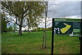
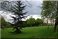
2
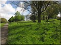
Norwood Park
The park is well documented at http://www.geograph.org.uk/search.php?i=41445970 . This is from close to the southwest entrance.
Image: © Derek Harper
Taken: 9 May 2013
0.03 miles
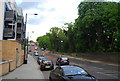
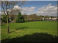
3
The South West corner of Norwood Park
Looking towards the junction of Crown Dale, Elder Road and Central Hill.
A number of prefabs were located around the perimeter of the park here following World War II.
Image: © Robin Drayton
Taken: 21 Dec 2015
0.03 miles
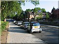
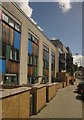
5
Houses on Crown Dale
A reverse view of Image], with some of the flats on the right.
Image: © Derek Harper
Taken: 9 May 2013
0.04 miles
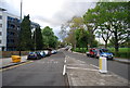
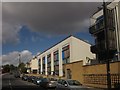
6
Houses on Crown Dale
Colourful modern town houses on the A214, which can be seen climbing Central Hill in the background. Together with the flats beyond, this forms part of a redevelopment of the site of an old people's home, later a hostel, on the corner of Elder Road, close to Norwood School.
Image: © Derek Harper
Taken: 9 May 2013
0.04 miles
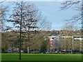
10
Norwood Park
From the path shown in Image, this looks across the line of view of Image and includes Elderwood http://list.english-heritage.org.uk/resultsingle.aspx?uid=1184933&searchtype=mapsearch , the housing shown in Image On the right is a fenced multi-purpose sports court.
Image: © Derek Harper
Taken: 9 May 2013
0.06 miles