IMAGES TAKEN NEAR TO
Surrey Quays Road, LONDON, SE16 7EE

Introduction

This page details the photographs taken nearby to Surrey Quays Road, SE16 7EE by members of the Geograph project.

The Geograph project started in 2005 with the aim of publishing, organising and preserving representative images for every square kilometre of Great Britain, Ireland and the Isle of Man.

There are currently over 7.5m images from over14,400 individuals and you can help contribute to the project by visiting https://www.geograph.org.uk

Image Map


Images are licensed for reuse under creativecommons.org/licenses/by-sa/2.0
Notes
  • Clicking on the map will re-center to the selected point.
  • The higher the marker number, the further away the image location is from the centre of the postcode.

Image Listing (382 Images Found)

Images are licensed for reuse under creativecommons.org/licenses/by-sa/2.0
  • ...
Image
Details
Distance
1
Canada Water underground station, Rotherhithe, London
Image: © Richard Humphrey Taken: 11 Nov 2010
0.00 miles
2
Maple Quays
A new housing development under construction close to Canada Water in Rotherhithe.
Image: © Martin Addison Taken: 22 Apr 2012
0.01 miles
3
Construction site on Surrey Quays Road
Part of a large housing development on the road. One block is almost finished, this one is still at the foundation stage. Image on Renforth Street is seen in the background.
Image: © David Anstiss Taken: 25 Sep 2011
0.01 miles
4
Memorial to the Rev Edward Blick
Rev Blick was rector of St Mary's Church in St Marychurch Street from 1835 to 1867. The memorial is in the grounds of the church - Adams Garden Estate in the background.
Image: © Chris Lordan Taken: 7 Mar 2006
0.02 miles
5
Rotherhithe Tunnel
South entrance to the tunnel showing the inscription
Image: © Chris Lordan Taken: 10 Mar 2007
0.02 miles
6
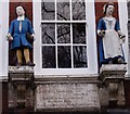
Peter Hills School
Close up of the statues of the 1797 school
Image: © Chris Lordan Taken: 21 Mar 2006
0.02 miles
7
Jolly Caulkers pub
At 126 Lower Road, Rotherhithe, SE16. The original had an additional floor and has seen a lot of changes. For many years it opened at 6-0am to cater for dock workers on night shift.
Image: © Chris Lordan Taken: 31 Jul 2007
0.02 miles
8
Little Crown pub
At 56 Albion Street junction with Renforth Street, Rotherhithe, SE16. 1857 to about 1998
Image: © Chris Lordan Taken: 29 Aug 2007
0.02 miles
9
Lord Nelson pub
At 66 / 68 Canon Beck Road (left) junction with Albion Street (right), Rotherhithe, SE16. Built about 1838 - current (2009). Other than having the Ainsty Estate attached to it about 1950, it has changed little externally.
Image: © Chris Lordan Taken: 29 Aug 2007
0.02 miles
10
The Rose & Crown pub
At 30 / 32 Albion Street, Rotherhithe. SE16. 50 yards to its left was the Crown pub and 50 yards to its right is the Albion pub. Dates - ?? As may be seen, it is now a cafe.
Image: © Chris Lordan Taken: 24 Jul 2009
0.02 miles
  • ...