IMAGES TAKEN NEAR TO
Burnside Close, LONDON, SE16 5SP
Introduction
This page details the photographs taken nearby to Burnside Close, SE16 5SP by members of the Geograph project.
The Geograph project started in 2005 with the aim of publishing, organising and preserving representative images for every square kilometre of Great Britain, Ireland and the Isle of Man.

There are currently over 7.5m images from over14,400 individuals and you can help contribute to the project by visiting https://www.geograph.org.uk
Image Map
Images are licensed for reuse under creativecommons.org/licenses/by-sa/2.0
Notes
- Clicking on the map will re-center to the selected point.
- The higher the marker number, the further away the image location is from the centre of the postcode.
Image Listing (204 Images Found)
Images are licensed for reuse under creativecommons.org/licenses/by-sa/2.0
Image
Details
Distance
2
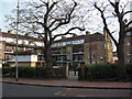
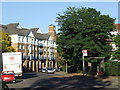
Boatswain and Call pub (site of) Rotherhithe Street, London, SE16
This stood from 1767 until 1810 at the junction with Charlotte Row, approximately where the right hand fir tree is shown. I'm not sure if this was once called the 'Charlotte Savage' as a pub with that name was in that immediate vicinity during the years shown. Just too difficult to even approximately isolate its location. Building on the far right is the ex Half Moon & Bulls Head pub.
Image: © Chris Lordan
Taken: 9 Dec 2009
0.04 miles
3
Half Moon & Bulls Head pub (ex) 238 Rotherhithe Street, London, SE16
Was about 500 yards east of the swing bridge near Brunel Road. First recorded in 1805 and closed about 1988. It was also known as 'Half Moon' and 'Bulls Head and Half Moon'. Since closing as a pub it has had three floors added and some changes to the front.
Image: © Chris Lordan
Taken: 19 Oct 2009
0.04 miles
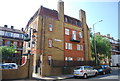
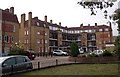
4
Dukes Head pub (site of) 268, Rotherhithe Street, London, SE16
First recorded about 1767 when called the 'Duke of York' and ceased trading in 1931 - possibly when the site was required for the Amos Estate shown in the image. The building on the left is now called 'Edinburgh Court' - I do not know of any connection with the word Edinburgh but about half a mile to the west (right) between 1867 and 1904 stood the 'Duke of Edinburgh' pub.
Image: © Chris Lordan
Taken: 1 Dec 2009
0.05 miles
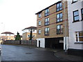
5
Amos Estate (part), Rotherhithe Street, London, SE16
There are another five buildings that complete the estate. The estate was named after the Rev. Andrew Amos (1863-1931) who in 1922 was the Rector of Clare College Mission in Abbeyfield Road, Rotherhithe. The estate was built upon Mestaers Buildings and an iron foundry.
Image: © Chris Lordan
Taken: 23 Sep 2009
0.05 miles
6
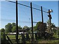
Disused golf driving range, Rotherhithe
The driving range is off Salter Road. This view is from a footpath between the range and the school playing fields. The high fence that spoils the view was obviously needed to keep golf balls from hitting users of the path. As of 2010 the range was derelict, with signs on the fence warning that unofficial use of the site was prohibited.
Image: © Stephen Craven
Taken: 23 May 2010
0.06 miles
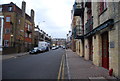
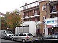
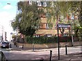
8
Rotherhithe Street, SE16
Bus stop on Rotherhithe Street.
Image: © Malc McDonald
Taken: 10 Oct 2010
0.07 miles
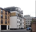
9
Ship Argo pub (site of) 312, Rotherhithe Street, London, SE16
This stood where the building (Lavender House) is shown, from 1805 until 1910.
Image: © Chris Lordan
Taken: 4 Nov 2009
0.07 miles