IMAGES TAKEN NEAR TO
Neckinger Estate, LONDON, SE16 3QF
Introduction
This page details the photographs taken nearby to Neckinger Estate, SE16 3QF by members of the Geograph project.
The Geograph project started in 2005 with the aim of publishing, organising and preserving representative images for every square kilometre of Great Britain, Ireland and the Isle of Man.

There are currently over 7.5m images from over14,400 individuals and you can help contribute to the project by visiting https://www.geograph.org.uk
Image Map
Images are licensed for reuse under creativecommons.org/licenses/by-sa/2.0
Notes
- Clicking on the map will re-center to the selected point.
- The higher the marker number, the further away the image location is from the centre of the postcode.
Image Listing (210 Images Found)
Images are licensed for reuse under creativecommons.org/licenses/by-sa/2.0
Image
Details
Distance
2
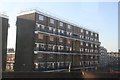
Neckinger, Bermondsey
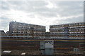
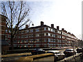
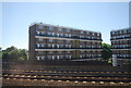
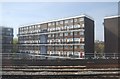
Neckinger. Not so much the name of a street as of the river that flows underground beneath Abbey Street at this end, as part of its 2.6 mile journey under South London. The Neckinger joins the Thames at St Saviour’s Dock. The watercourse provided a water supply for tanneries and factories. One of the largest leather factories in Bermondsey was Bevington’s Neckinger Mills on Abbey Street Image The housing shown here is typical of the old LCC (London County Council) estates.
Image: © Stephen Craven
Taken: 25 Jan 2014
0.05 miles
5
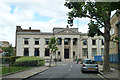
Former Borough of Bermondsey Municipal Offices
Bermondsey is now part of Southwark. A grade II listed building, built 1928 -30.
Image: © Robin Webster
Taken: 23 Jul 2011
0.07 miles
7
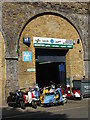
68 Enid Street SE1
Scooter shop under the arches of the London Bridge railway line. I lived here in the late eighties and early nineties before all the regeneration and gentrification. There was always an odd corner worth exploring. It felt like I was on constant holiday.
Image: © John Kingdon
Taken: 29 Jun 2013
0.07 miles
8
Bermondsey Municipal Offices
Grade II listed building on Spa Road.
See http://www.britishlistedbuildings.co.uk/en-471350-bermondsey-municipal-offices-and-attache for more details about the building.
Image: © David Anstiss
Taken: 25 Sep 2011
0.07 miles
9
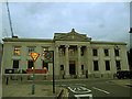
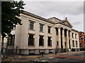
Bermondsey council offices, Spa Road
The offices were built 1928-1930 by Henry Tansley as an annexe to the Town Hall which was destroyed in the War. Listed grade 2 (list entry number 1385930). See also Image
Image: © Stephen Craven
Taken: 7 Oct 2013
0.07 miles
10
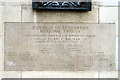
Borough of Bermondsey Municipal Offices - foundation stone
Image: © Robin Webster
Taken: 23 Jul 2011
0.07 miles