1
Rotherhithe Free Church
An Evangelical church located on Lower Road at the junction with Culling Road. Interestingly, there is a funeral directors at the end of Culling Road - I do hope they aren't creating business for themselves in the Hammer Horror tradition ;-)
Image: © Martin Addison
Taken: 22 Oct 2010
0.00 miles
2
Rotherhithe Free Church - Lower Road, Rotherhithe, SE16
Situated at the junction with Culling Road. The site was originally that of the Terris Theatre, later Rotherhithe Hippodrome, 32-36, Lower Road. The theatre opened Monday 16th October 1899 and changed its name in 1907. Suffered very little in the war but was demolished in 1955.
Image: © Chris Lordan
Taken: 9 Sep 2009
0.01 miles
3
Rotherhithe Free Church, Lower Road SE16
At the junction with Culling Road
Image: © Robin Sones
Taken: 26 Feb 2013
0.01 miles
4
Culling Road, Rotherhithe
Image: © Alex McGregor
Taken: 19 Aug 2010
0.02 miles
5
Arthur Stanley House - Culling Road, Rotherhithe, SE16
Home of F.A. Albin & Son since about 1974. A partner in the firm was Frederick Albin who asked his partner, George Dyer, to name the building. 'Arthur' was the father of Frederick and 'Stanley' was Frederick's brother. Stanley was killed in WWII whilst serving as a fighter pilot. The site originally housed 'Runge Hall' named after Mrs Norah Cecelia Runge OBE, Conservative MP for Bermondsey in 1931.
Image: © Chris Lordan
Taken: 9 Sep 2009
0.02 miles
6
A200, Lower Road, SE16
Heading towards London Bridge.
Image: © Robin Webster
Taken: 6 Apr 2019
0.03 miles
7
Anchor pub (site of). 85, Lower Road, Rotherhithe, London, SE16
A small three storeyed building just north of Neptune Street. Built about 1843 and demolished in 1958. Building in the background is Blick House.
Image: © Chris Lordan
Taken: 4 Nov 2009
0.04 miles
8
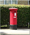
Victorian postbox on Lower Road, London SE16
Postbox No. SE16 17.
See
Image] for context.
Image: © JThomas
Taken: 20 Jun 2022
0.04 miles
9
Houses on Lower Road, London SE16
Showing position of postbox No. SE16 17.
See
Image] for postbox.
Image: © JThomas
Taken: 20 Jun 2022
0.05 miles
10
Sir Michael Caine Plaque
Mounted on the old gatehouse this being the only remaining part of St Olave’s Hospital still standing. Lower Road, Rotherhithe.
Image: © David Lunn
Taken: 23 Sep 2005
0.06 miles


