1
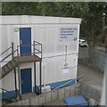
Network Rail establishment
Signed 'East London Line Infrastructure Maintenance Facility'. The view is from the ramp up to the footbridge that connects Oldfield Grove and Trundley's Terrace.
Image: © Robin Stott
Taken: 29 Aug 2024
0.02 miles
2
Island Road, Rotherhithe
A recent building development to the west of Oldfield Grove, viewed from the railway footbridge.
Image: © Stephen Craven
Taken: 27 Apr 2010
0.03 miles
3
South of Surrey Quays
An Overground train soon after leaving Surrey Quays station is seen from a footbridge. The train is keeping to the eastern-most track so it's most likely heading for New Cross Gate and points south: West Croydon or Crystal Palace.
Photo number 7885441.
Image: © Robin Stott
Taken: 29 Aug 2024
0.04 miles
4
Southbound Overground train on the former East London Line
Image: © David Martin
Taken: 10 Apr 2022
0.04 miles
5
Footbridge at Deptford Road Junction
The footbridge over the former East London Line railway, linking Trundleys Road to Oldfield Grove, was rebuilt with access ramps each side as part of the redevelopment of the junction for the London Overground project.
Image: © Stephen Craven
Taken: 27 Apr 2010
0.04 miles
6
Site of Royal William public house
The Royal William public house was at 15 St Helena Road, Rotherhithe, SE16 from 1852 to 1865. The site, and a much larger area, later became the St Helena Tea Gardens which incorporated the St Helena Tavern. Possibly the Royal William was demolished for this project or was left intact and renamed the St Helena tavern.
Image: © Chris Lordan
Taken: 20 Feb 2011
0.05 miles
7
New track layout at Deptford Road Junction
The junction was where the former line to Peckham met the line from New Cross on the former East London Line. The Peckham tracks were lifted as early as 1913 though one track to the west side of New Cross Gate survived until 1964 [source: London Railway Atlas by Joe Brown]. As part of the redevelopment of the route for London Overground, a stub of track was laid (left foreground) to permit the Peckham route to be reinstated at a later date. The track at the far side of the formation is the northbound track from New Cross Gate that now uses a new flyover - see
Image Behind it is a ramp to the new footbridge.
Image: © Stephen Craven
Taken: 27 Apr 2010
0.05 miles
8
Oldfield Grove, Deptford
Just showing on the right is the Network Rail facility first seen in
Image
Photo number 7885393.
Image: © Robin Stott
Taken: 29 Aug 2024
0.05 miles
9
St Helena Road (part), Rotherhithe, London, SE16
Did at one time extend to Silwood Street. It was about this location in the early 1700's where the famous St Helena Tea Gardens stood. It was built on the periphery of the events concerning the Mill Pond and described as a general purpose entertainment area. It comprised of two fish ponds with yew trees forming alcoves, two Chinese pavilions surrounded by weeping willows and similar. Nearby was the parade ground where the Rotherhithe Volunteers trained.
Image: © Chris Lordan
Taken: 23 Sep 2009
0.06 miles
10
Railway junction south of Surrey Quays
A complex area of tracks, where the former East London Line has been integrated into the Overground network.
Image: © David Martin
Taken: 10 Apr 2022
0.06 miles


