1
Former canal path, Burgess Park
Springtime in Burgess Park, with cherry trees in bossom.
The park occupies land which was formerly streets, housing and light industry flanking a canal. The path in this image follows the route of the canal, which was filled in in the 1980s. The footbridge survives as a reminder that the canal used to be here.
Image: © Malc McDonald
Taken: 8 Apr 2011
0.06 miles
2
Springtime in Burgess Park
Burgess Park in South London has been created on land which was formerly a canal flanked by factories, warehouses and residential streets. This wide path follows the route of the canal, which was filled in in the 1980s. The footbridge in the distance used to cross the canal.
The path is lined with cherry trees, which are covered in blossom for a short period in April each year.
Image: © Malc McDonald
Taken: 8 Apr 2011
0.06 miles
3
Springtime in Burgess Park
Burgess Park in South London has been created on land which was formerly a canal flanked by factories, warehouses and residential streets. This wide path follows the route of the canal, which was filled in in the 1980s.
The path is lined with cherry trees, which are covered in blossom for a short period in April each year.
Image: © Malc McDonald
Taken: 8 Apr 2011
0.06 miles
4
Gloucester Primary School, Peckham North
Built in 1870s as Gloucester Road School, just south of Burgess Park - famous alumni include Lord Harris, founder of Carpetright.
Image: © Phil
Taken: 24 Apr 2008
0.07 miles
5
Spring blossom in Burgess Park
Young trees both sides of the main east-west path through the park, on the line of the old Surrey Canal. Another contributor took a similar photo at exactly the same time of year in 2011
Image
Image: © Stephen Craven
Taken: 14 Apr 2015
0.07 miles
6
Runners, Burgess Park
Image: © N Chadwick
Taken: 3 Feb 2018
0.07 miles
7
Burgess Park on a sunny day
Looking west along the central path through the park, which is a well-used cycle route on the alignment of the former Surrey Canal. In the background is the former St George's church
Image
Image: © Stephen Craven
Taken: 21 Oct 2014
0.08 miles
8
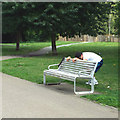
Keeping fit with the help of a bench, Burgess Park
Interesting seat assembled from timber slats supported by a cast aluminium frame – sufficient support for an exercise.
Image: © Robin Stott
Taken: 25 Aug 2013
0.08 miles
9
Burgess Park
Photo taken near Sumner Road and the Trafalgar Bridge which used to go over a canal. See the historic map for a contrast -- the area was much more built up then.
Image: © Danny P Robinson
Taken: 14 Jan 2007
0.09 miles
10
New buildings for Tuke School
Until 2010, Tuke Special School was situated on Woods Road
Image
As of 2010 this replacement building was in construction, due to open in September 2010. It will "provide specialist facilities for all students with Profound and Complex Learning difficulties" according to the school's website http://www.tukeschool.co.uk/ .
Image: © Stephen Craven
Taken: 4 Jun 2010
0.09 miles


