Former canal path, Burgess Park
Introduction
The photograph on this page of Former canal path, Burgess Park by Malc McDonald as part of the Geograph project.
The Geograph project started in 2005 with the aim of publishing, organising and preserving representative images for every square kilometre of Great Britain, Ireland and the Isle of Man.

There are currently over 7.5m images from over 14,400 individuals and you can help contribute to the project by visiting https://www.geograph.org.uk
Former canal path, Burgess Park
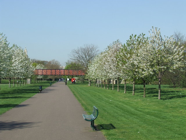
Image: © Malc McDonald Taken: 8 Apr 2011
Springtime in Burgess Park, with cherry trees in bossom. The park occupies land which was formerly streets, housing and light industry flanking a canal. The path in this image follows the route of the canal, which was filled in in the 1980s. The footbridge survives as a reminder that the canal used to be here.
Images are licensed for reuse under creativecommons.org/licenses/by-sa/2.0
Image Location
Latitude
51.482405
Longitude
-0.078109