IMAGES TAKEN NEAR TO
Lewisham Park, LONDON, SE13 6QL
Introduction
This page details the photographs taken nearby to Lewisham Park, SE13 6QL by members of the Geograph project.
The Geograph project started in 2005 with the aim of publishing, organising and preserving representative images for every square kilometre of Great Britain, Ireland and the Isle of Man.

There are currently over 7.5m images from over14,400 individuals and you can help contribute to the project by visiting https://www.geograph.org.uk
Image Map
Images are licensed for reuse under creativecommons.org/licenses/by-sa/2.0
Notes
- Clicking on the map will re-center to the selected point.
- The higher the marker number, the further away the image location is from the centre of the postcode.
Image Listing (194 Images Found)
Images are licensed for reuse under creativecommons.org/licenses/by-sa/2.0
Image
Details
Distance
1
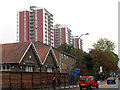
Tower blocks near Lewisham
The three blocks are on the east side of Lewisham High Street opposite the hospital. Their names from north to south (left to right in this photo) are Malling House, Bredgar House and Kemsley House.
Image: © Stephen Craven
Taken: 13 Oct 2011
0.05 miles
3
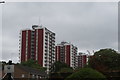
View of Lewisham Park Towers from the path leading to the Lewisham Parish Church of Saint Mary the Virgin #2
Looking north-northeast.
Image: © Robert Lamb
Taken: 19 Aug 2018
0.07 miles
4
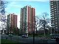
Tower Blocks on Lewisham High Street
These blocks are opposite University Hospital Lewisham. From left to right, the blocks are called Malling, Bredgar and Kemsley -- named after 3 Kent villages. A war memorial is also visible to the left of the picture.
Image: © Danny P Robinson
Taken: 14 Jan 2007
0.07 miles
6
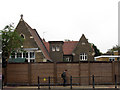
St Mary's primary school, Lewisham
The school is opposite the parish church on Lewisham High Street. It is now enclosed by a high wooden security fence.
Image: © Stephen Craven
Taken: 13 Oct 2011
0.08 miles
7
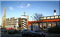
Lewisham Fire Station and Leisure Centre
in Lewisham High Street. The fire station is the setting for Bridget Jones's ignominious television appearance http://www.imdb.com/title/tt0243155/ . Beyond, in Image is Lewisham Congregational Church, built in 1867. http://www.ideal-homes.org.uk/lewisham/lewisham/lewisham-high-street-1874.htm view from roughly the same position in c. 1874.
Image: © Roger W Haworth
Taken: 25 Feb 2006
0.09 miles
8
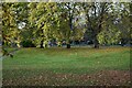
View across the sunken garden, Lewisham Park
Image: © David Martin
Taken: 29 Oct 2022
0.09 miles
9
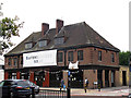
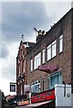
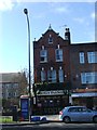
The Ravensbourne Arms
This pub on the corner of Lewisham High Street and Romborough Way takes its name from the nearby river.
Image: © Stephen Craven
Taken: 13 Oct 2011
0.10 miles