IMAGES TAKEN NEAR TO
Eton Grove, LONDON, SE13 5BY
Introduction
This page details the photographs taken nearby to Eton Grove, SE13 5BY by members of the Geograph project.
The Geograph project started in 2005 with the aim of publishing, organising and preserving representative images for every square kilometre of Great Britain, Ireland and the Isle of Man.

There are currently over 7.5m images from over14,400 individuals and you can help contribute to the project by visiting https://www.geograph.org.uk
Image Map
Images are licensed for reuse under creativecommons.org/licenses/by-sa/2.0
Notes
- Clicking on the map will re-center to the selected point.
- The higher the marker number, the further away the image location is from the centre of the postcode.
Image Listing (122 Images Found)
Images are licensed for reuse under creativecommons.org/licenses/by-sa/2.0
Image
Details
Distance
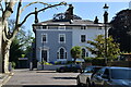
2
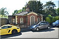
Quentin Road, London SE13
Spring 2002 Taken looking north towards Lee Terrace
Image: © Steve Haywood
Taken: 14 Apr 2002
0.05 miles
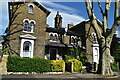
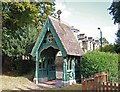
6
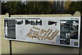
Village of Lee and its Victorian Transformation
An excellent information board describing the Victorian transformation of Lee, primarily driven by the arrival of the railways.
Image: © David Martin
Taken: 29 Oct 2022
0.07 miles