IMAGES TAKEN NEAR TO
Southampton Row, PEMBROKE DOCK, SA72 6YE
Introduction
This page details the photographs taken nearby to Southampton Row, SA72 6YE by members of the Geograph project.
The Geograph project started in 2005 with the aim of publishing, organising and preserving representative images for every square kilometre of Great Britain, Ireland and the Isle of Man.

There are currently over 7.5m images from over14,400 individuals and you can help contribute to the project by visiting https://www.geograph.org.uk
Image Map
Images are licensed for reuse under creativecommons.org/licenses/by-sa/2.0
Notes
- Clicking on the map will re-center to the selected point.
- The higher the marker number, the further away the image location is from the centre of the postcode.
Image Listing (65 Images Found)
Images are licensed for reuse under creativecommons.org/licenses/by-sa/2.0
Image
Details
Distance
1
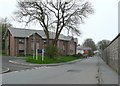
Fort Road, Pembroke Dock
The South Pembrokeshire Hospital is on the left, replacing or incorporating the Admiralty Hospital, which was further down the road. The dockyard wall is on the right.
Image: © Humphrey Bolton
Taken: 31 Mar 2011
0.01 miles
2
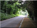
Fort Road, Pembroke Dock
The dock wall is on the right. Beyond this view is access to the Flying Boat Museum: highly recommended.
Image: © Peter Whatley
Taken: 22 Jul 2009
0.05 miles
3
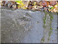
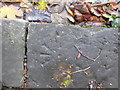
Ordnance Survey Pivot
This OS pivot can be found on a Kerb stone at the junction of Melville Terrace & Victoria Road. It marks a point 25.121m above mean sea level.
Image: © Adrian Dust
Taken: 31 Oct 2015
0.05 miles
5
Ordnance Survey Pivot
This OS pivot can be found on a Kerb stone, west side of Melville Terrace. It marks a point 17.155m above mean sea level.
Image: © Adrian Dust
Taken: 31 Oct 2015
0.06 miles
6
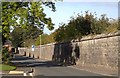
Pembroke Dockyard Wall
The substantial boundary wall of the former Royal Dockyard in Fort Street.
Image: © Arthur C Harris
Taken: 10 Oct 2016
0.07 miles
7
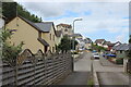
St Patrick Hill, Llanreath
Path to cul-de-sac, one of several on St Patrick Hill.
Image: © M J Roscoe
Taken: 4 Jul 2023
0.08 miles
8
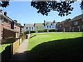
Green space between Melville Terrace and Cumby Terrace
Image: © Jonathan Thacker
Taken: 22 Jun 2018
0.10 miles
9
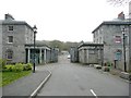
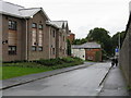
Admiralty Way, Pembroke Dock
This road narrows at a gateway between buildings before continuing to Fort Road.
Image: © Humphrey Bolton
Taken: 31 Mar 2011
0.10 miles
10
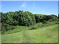
Footpath on Patrick's Hill
Cuts across the golf course.
Image: © Jonathan Thacker
Taken: 22 Jun 2018
0.11 miles