1
Cwm Gwennol, Saundersfoot
From the south side of the B4316, Cwm Gwennol leads to Nyth Gwennol, the right turn 75 metres ahead.
Image: © Jaggery
Taken: 16 Jul 2016
0.04 miles
2
Rushy Lake bungalows, Saundersfoot
Viewed across the B4316 Broadfield Hill.
Image: © Jaggery
Taken: 16 Jul 2016
0.06 miles
3
Broadfield Hill bus stop and shelter, Saundersfoot
This bus stop alongside the B4316 Broadfield Hill is for buses to the centre of Saundersfoot.
Image: © Jaggery
Taken: 16 Jul 2016
0.07 miles
4
Fibre broadband telecoms cabinet, Saundersfoot
Alongside the B4316 opposite the Stammers Lane junction.
A label on the cabinet shows 'Fibre Broadband is here' and its Welsh equivalent.
Image: © Jaggery
Taken: 16 Jul 2016
0.07 miles
5
Telecoms equipment on a south Saundersfoot corner
A telecoms cabinet and a BT phonebox are on the corner of the B4316 and Stammers Lane. http://www.geograph.org.uk/photo/5168004
Image: © Jaggery
Taken: 16 Jul 2016
0.08 miles
6
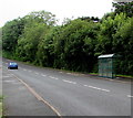
Bus shelter near Cwm Gwennol, Saundersfoot
Alongside the B4316 near the Cwm Gwennol junction http://www.geograph.org.uk/photo/5167984 in the south of Saundersfoot.
This side of the road for buses to Tenby.
Image: © Jaggery
Taken: 16 Jul 2016
0.09 miles
7
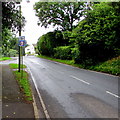
Combined speed limit and speed camera sign, Saundersfoot
Alongside the B4316 in the south of Saundersfoot.
Image: © Jaggery
Taken: 16 Jul 2016
0.09 miles
8
Broadfield Hill bungalows, Saundersfoot
On the west side of the B4316 Broadfield Hill.
Image: © Jaggery
Taken: 16 Jul 2016
0.09 miles
9
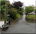
Stammers Lane, Saundersfoot
Stammers Lane ascends from the B4316 in the south of Saundersfoot.
Image: © Jaggery
Taken: 16 Jul 2016
0.12 miles
10
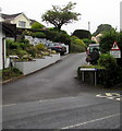
Bevelin Lane, Saundersfoot
From the B4316 Bevelin Lane ascends towards Scandinavia Heights.
Image: © Jaggery
Taken: 16 Jul 2016
0.12 miles


