IMAGES TAKEN NEAR TO
Lampeter Velfrey, NARBERTH, SA67 8UQ
Introduction
This page details the photographs taken nearby to SA67 8UQ by members of the Geograph project.
The Geograph project started in 2005 with the aim of publishing, organising and preserving representative images for every square kilometre of Great Britain, Ireland and the Isle of Man.

There are currently over 7.5m images from over14,400 individuals and you can help contribute to the project by visiting https://www.geograph.org.uk
Image Map
Images are licensed for reuse under creativecommons.org/licenses/by-sa/2.0
Notes
- Clicking on the map will re-center to the selected point.
- The higher the marker number, the further away the image location is from the centre of the postcode.
Image Listing (52 Images Found)
Images are licensed for reuse under creativecommons.org/licenses/by-sa/2.0
Image
Details
Distance
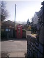
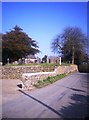
1
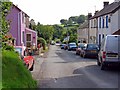
Main street, Lampeter Velfrey
Lampeter Velfrey (in Welsh Llanbedr Efelfre) is a large parish comprising the southern half of the ancient commote of Efelfre. It belonged to the Welsh-speaking, northern-eastern part of Pembrokeshire, but began to be anglicized in the 19th century, and there is now only a small minority of native Welsh speakers. By contrast, Llanddewi Velfrey (to the north of the Afon Marlais) still has a majority of native Welsh speakers.
Image: © Dylan Moore
Taken: 12 Sep 2008
0.10 miles
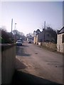
3
School Room, Lampeter Velfrey
This was the church school. Lewis's Topographical Dictionary (1833) says "A parochial school, for the gratuitous instruction of poor children, is supported by subscription." The present building was constructed on the previous school's site in 1854, and functioned until 1905.
Image: © Dylan Moore
Taken: 12 Sep 2008
0.13 miles
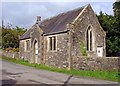
4
Lampeter Velfrey Village Hall/Old Schoolroom
Image: © welshbabe
Taken: 12 Mar 2014
0.13 miles
5
Village hall
The village hall, Llanbedr Felfre.
Image: © Alan Hughes
Taken: 26 Feb 2021
0.13 miles
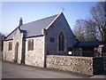
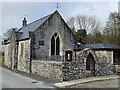
9
St Peter's Church, Lampeter Velfrey - part of carpark
Image: © welshbabe
Taken: 12 Mar 2014
0.15 miles
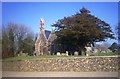
10
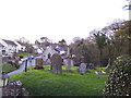
St Peter's Church Lampeter Velfrey - graveyard
Image: © welshbabe
Taken: 3 Feb 2016
0.15 miles