School Room, Lampeter Velfrey
Introduction
The photograph on this page of School Room, Lampeter Velfrey by Dylan Moore as part of the Geograph project.
The Geograph project started in 2005 with the aim of publishing, organising and preserving representative images for every square kilometre of Great Britain, Ireland and the Isle of Man.

There are currently over 7.5m images from over 14,400 individuals and you can help contribute to the project by visiting https://www.geograph.org.uk
School Room, Lampeter Velfrey
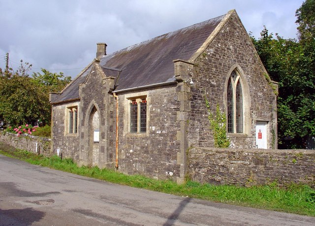
Image: © Dylan Moore Taken: 12 Sep 2008
This was the church school. Lewis's Topographical Dictionary (1833) says "A parochial school, for the gratuitous instruction of poor children, is supported by subscription." The present building was constructed on the previous school's site in 1854, and functioned until 1905.
Images are licensed for reuse under creativecommons.org/licenses/by-sa/2.0
Image Location


Leaflet Map data © OpenStreetMap
Latitude
51.797899
Longitude
-4.677625