IMAGES TAKEN NEAR TO
Llangrannog, LLANDYSUL, SA44 6SD
Introduction
This page details the photographs taken nearby to SA44 6SD by members of the Geograph project.
The Geograph project started in 2005 with the aim of publishing, organising and preserving representative images for every square kilometre of Great Britain, Ireland and the Isle of Man.

There are currently over 7.5m images from over14,400 individuals and you can help contribute to the project by visiting https://www.geograph.org.uk
Image Map
Images are licensed for reuse under creativecommons.org/licenses/by-sa/2.0
Notes
- Clicking on the map will re-center to the selected point.
- The higher the marker number, the further away the image location is from the centre of the postcode.
Image Listing (42 Images Found)
Images are licensed for reuse under creativecommons.org/licenses/by-sa/2.0
Image
Details
Distance
1

Statue of Cranogwen
Only the third sculpture in Wales to be of a woman, this statue of the poet Cranogwen (Sarah Jane Rees) was unveiled in 2023.
Image: © TCExplorer
Taken: 12 Jul 2025
0.01 miles
2
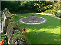
Birdbath with mosaic
The mosaic was created by Beryl Jones and Morwen Reynolds in September 2002 as part of a "little arts school".
Image: © Eirian Evans
Taken: 12 Jul 2013
0.01 miles
3
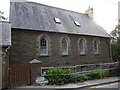
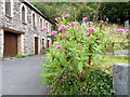
Holiday accommodation in Llangrannog
This building is apparently available for holiday lets.
Image: © Jeremy Bolwell
Taken: 15 Sep 2011
0.03 miles
4
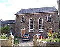
Bancyfelin Chapel, Llangrannog
Now privately owned this Chapel was named Bancyfelin after Thomas Thomas the owner of the Mill which is on the same bank of the river and who helped to establish it.
Previous nonconformist religious meetings were held in Llangrannogs Corn Mill, and also at Lochtyn farm.
Image: © Cered
Taken: 19 Aug 2005
0.04 miles
5
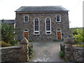
Converted chapel in Llangrannog
Another holiday let I believe.
Image: © Jeremy Bolwell
Taken: 15 Sep 2011
0.04 miles
6
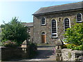
Banc-y-felin
Bancyfelin Methodist Chapel was built in 1863 and modified in 1872 and 1888. By 1995 the chapel had fallen into disuse and by 1998 converted into residential accommodation. The building is now Grade 2 listed.
Image: © Eirian Evans
Taken: 12 Jul 2013
0.04 miles
7
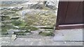
Ordnance Survey Cut Mark
This OS cut mark can be found on No2 Granrhaeadr. It marks a point 38.590m above mean sea level.
Image: © Adrian Dust
Taken: 1 Jul 2021
0.04 miles
8
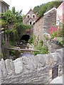
Nant Hawen, Llangrannog
The plaque on the bridge in the foreground which carries the B4334 road reads 'Pont-y-Pump - J.Owen, T.Evans, J.Davies, G.Griffiths, D.Jones, 1884'
The dark 'tunnel' into which the river flows in the background is the forecourt to the Bancyfelin Chapel which can just be seen on the left and also in Image]
Image: © John Brightley
Taken: 21 Jun 2003
0.04 miles
9
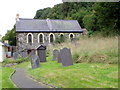
Parish Rooms, Llangrannog
The Parish Rooms were built in 1904. The churchyard of St Carannogs has been left wild to encourage wildlife. For a view of the date stone Image
Image: © Maigheach-gheal
Taken: 21 Sep 2010
0.05 miles