Nant Hawen, Llangrannog
Introduction
The photograph on this page of Nant Hawen, Llangrannog by John Brightley as part of the Geograph project.
The Geograph project started in 2005 with the aim of publishing, organising and preserving representative images for every square kilometre of Great Britain, Ireland and the Isle of Man.

There are currently over 7.5m images from over 14,400 individuals and you can help contribute to the project by visiting https://www.geograph.org.uk
Nant Hawen, Llangrannog
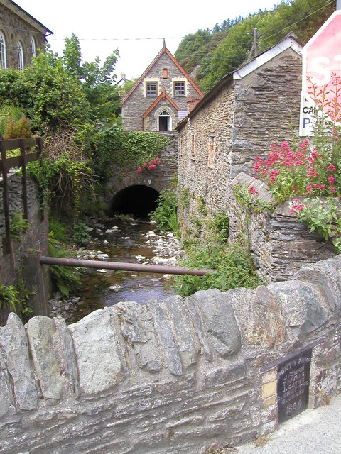
Image: © John Brightley Taken: 21 Jun 2003
The plaque on the bridge in the foreground which carries the B4334 road reads 'Pont-y-Pump - J.Owen, T.Evans, J.Davies, G.Griffiths, D.Jones, 1884' The dark 'tunnel' into which the river flows in the background is the forecourt to the Bancyfelin Chapel which can just be seen on the left and also in Image]
Images are licensed for reuse under creativecommons.org/licenses/by-sa/2.0
Image Location
Latitude
52.158694
Longitude
-4.463541