Bancyfelin Chapel, Llangrannog
Introduction
The photograph on this page of Bancyfelin Chapel, Llangrannog by Cered as part of the Geograph project.
The Geograph project started in 2005 with the aim of publishing, organising and preserving representative images for every square kilometre of Great Britain, Ireland and the Isle of Man.

There are currently over 7.5m images from over 14,400 individuals and you can help contribute to the project by visiting https://www.geograph.org.uk
Bancyfelin Chapel, Llangrannog
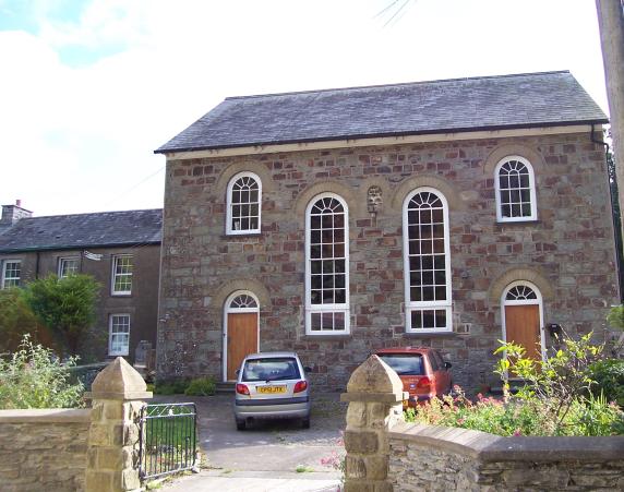
Image: © Cered Taken: 19 Aug 2005
Now privately owned this Chapel was named Bancyfelin after Thomas Thomas the owner of the Mill which is on the same bank of the river and who helped to establish it. Previous nonconformist religious meetings were held in Llangrannogs Corn Mill, and also at Lochtyn farm.
Images are licensed for reuse under creativecommons.org/licenses/by-sa/2.0
Image Location


Leaflet Map data © OpenStreetMap
Latitude
52.15849
Longitude
-4.464699