IMAGES TAKEN NEAR TO
Nevern, NEWPORT, SA42 0PD
Introduction
This page details the photographs taken nearby to SA42 0PD by members of the Geograph project.
The Geograph project started in 2005 with the aim of publishing, organising and preserving representative images for every square kilometre of Great Britain, Ireland and the Isle of Man.

There are currently over 7.5m images from over14,400 individuals and you can help contribute to the project by visiting https://www.geograph.org.uk
Image Map
Images are licensed for reuse under creativecommons.org/licenses/by-sa/2.0
Notes
- Clicking on the map will re-center to the selected point.
- The higher the marker number, the further away the image location is from the centre of the postcode.
Image Listing (6 Images Found)
Images are licensed for reuse under creativecommons.org/licenses/by-sa/2.0
Image
Details
Distance
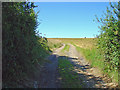
3
Country lane
Track at Pantygroes near Moylgrove.
Image: © Alan Hughes
Taken: 27 Jun 2018
0.15 miles
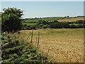
5
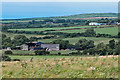
Field boundary near Tre-ricert, Nevern
The place-name is interesting. Although North Pembrokeshire is intensely Welsh in culture, many of the more important settlements have English names, dating from the period of the Anglo-Norman invasion, when manors were handed out to the conquerors' fellow-travellers. This north-eastern part of the parish of Nevern was originally called Hodiston (as given in 1347), because it belonged to the Hood family, who came (as many did) from South Devon (see Image). At some point it was divided between brothers Richard Hood and Jordan Hood. So one part became known as Jordanston (translated as Tref-wrdan). The part east of the brook was called Ricardston, Richardston or Rikerston in the 16th century. Welsh forms were Tref Richard, Trefricard, Tre Rickart, or even Tre Rickart Hwd. From the 18th century, in local pronunciation the -r- was dropped, but the Victorian Ordnance Survey maps, which used names approved by local clergy and gentry, still gave it as "Tre-reikert".
Image: © Dylan Moore
Taken: 24 Mar 2019
0.23 miles
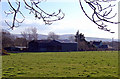
6
Tumulus, Bayvil
All that is visible is the rough tussock of grass in mid view.
Image: © Dylan Moore
Taken: 9 Aug 2012
0.25 miles