1
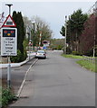
Southern boundary of Llandybie
The A483 north from Ammanford reaches the boundary sign for Llandybie, a large village in Carmarthenshire. The sign shows that Llandybie is twinned with Plonéour-Lanvern in Brittany. The speed limits drops from 40mph to 30mph.
Image: © Jaggery
Taken: 1 May 2015
0.07 miles
2
End of the 30mph speed limit in Llandybie
The speed limit on the A483 increases to 40mph.
The Llandybie southern boundary signs http://www.geograph.org.uk/photo/4457145 are on the back of the 40 signs.
Image: © Jaggery
Taken: 1 May 2015
0.07 miles
3
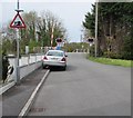
Blind summit warning sign south of Llandybie
Alongside the A483 Bonllwyn Road.
Image: © Jaggery
Taken: 1 May 2015
0.08 miles
4
A483 northbound at Llandybie village boundary
Image: © Colin Pyle
Taken: 19 Sep 2015
0.08 miles
5
Green text on a street name sign in Llandybie
Most of the street name signs in Llandybie are of the style and colour http://www.geograph.org.uk/photo/4442848 typical in Carmarthenshire. In this part in the south of the village, I noticed several different style signs with green text, such as the one on the right, which shows the unusual street name (for a Welsh village) of McKays.
Image: © Jaggery
Taken: 1 May 2015
0.08 miles
6
STOP when lights show ahead, Llandybie
The sign is on the eastern approach to Brynmarlais Crossing http://www.geograph.org.uk/photo/4456045 across the Heart of Wales Line.
Image: © Jaggery
Taken: 1 May 2015
0.12 miles
7
Heart of Wales Line towards Ammanford from Brynmarlais Crossing, Llandybie
Looking south from here. http://www.geograph.org.uk/photo/4456045
Image: © Jaggery
Taken: 1 May 2015
0.12 miles
8
Risk of grounding sign, McKays, Llandybie
Alongside the street named McKays, the sign depicting an exaggerated mound beneath a grounded
vehicle warns of the possibility of long vehicles grounding on the level crossing ahead. http://www.geograph.org.uk/photo/4456045
Image: © Jaggery
Taken: 1 May 2015
0.14 miles
9
River near Brynmarlais Crossing, Llandybie
Afon Marlas viewed from a bridge 35 metres west of this http://www.geograph.org.uk/photo/4456045 Heart of Wales Line level crossing.
Image: © Jaggery
Taken: 1 May 2015
0.14 miles
10
Heol Ceirios, Llandybie
Residential street on the east side of the A483 Ammanford Road.
Image: © Jaggery
Taken: 1 May 2015
0.14 miles


