1
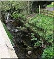
Gwyddfan flows below Ammanford Road, Llandybie
A tributary of the Afon Marlas, the stream Gwyddfan here flows below
the west side of the A483 Ammanford Road in the south of Llandybie.
Image: © Jaggery
Taken: 1 May 2015
0.04 miles
2
Heart of Wales Line south from Llandybie towards Ammanford
Viewed from the A483 Ammanford Road.
Ammanford station http://www.geograph.org.uk/photo/4345208 is about 2.2 km ahead.
A small yellow quarter-mile post shows the number 12 above
three vertical black lines, railway code for 12¾ miles.
This is likely to be the distance to Llanelli station,
or to Llandeilo Junction, where this line diverges
from the main line east of Llanelli station.
Image: © Jaggery
Taken: 1 May 2015
0.06 miles
3
Midway Garage and Ammanford Car Wash, Llandybie
Viewed across the A483 Ammanford Road in the south of Llandybie.
Image: © Jaggery
Taken: 1 May 2015
0.06 miles
4
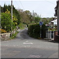
Unnamed access lane to a farm, Llandybie
The sign on the north side of Ammanford Road shows that the lane is not a through route.
It leads to Llangwyddfan Farm, nearly a kilometre ahead.
Image: © Jaggery
Taken: 1 May 2015
0.06 miles
5
Stone sides of a stream bridge, Llandybie
The A483 Ammanford Road crosses over a stream named Gwyddfan. http://www.geograph.org.uk/photo/4455655
Image: © Jaggery
Taken: 1 May 2015
0.07 miles
6
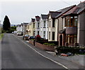
Maidens Grove, Llandybie
Houses on the south side of the A483 Ammanford Road.
The Heart of Wales railway is a few metres out of shot on the left.
A sign behind the camera shows that Maidens Grove leads to Gelli Road.
Image: © Jaggery
Taken: 1 May 2015
0.07 miles
7
Royal Oak Court junction, Llandybie
Viewed across the A483 Ammanford Road. The green text on the street name sign
on the left shows Royal Oak Court below the Welsh Llys Derwen Brenhinol.
Image: © Jaggery
Taken: 1 May 2015
0.11 miles
8
Ordnance Survey Rivet
This Ordnance Survey NBM Rivet can be found on the Culvert, W side of Ammanford Road. It marks a point 55.6640m above mean sea level.
Image: © Adrian Dust
Taken: 16 Jun 2013
0.13 miles
9
Down Glynhir Road, Llandybie
Glynhir Road descends towards the A483 Ammanford Road.
Image: © Jaggery
Taken: 1 May 2015
0.14 miles
10
A483 crosses the railway
Image: © Colin Pyle
Taken: 5 May 2012
0.14 miles


