1
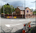
Abandoned buildings alongside the A48 south of Margam
Two of several adjacent abandoned buildings alongside the A48 near the Water Street junction.
The one on the right retains a sign showing A1 Auto Dismantlers.
Image: © Jaggery
Taken: 19 Apr 2012
0.04 miles
2
Ordnance Survey Flush Bracket (G3803)
This OS Flush Bracket can be found on the south face of the Saw Mills building. It marks a point 19.339m above mean sea level.
Image: © Adrian Dust
Taken: 10 Mar 2016
0.05 miles
3
Ordnance Survey Cut Mark
This OS cut mark can be found on the building NE side of the road. It marks a point 19.385m above mean sea level.
Image: © Adrian Dust
Taken: 9 Jun 2020
0.08 miles
4
Water Street/A48 junction
Image: © Colin Pyle
Taken: 29 Aug 2010
0.10 miles
5
Cwrt-y-defaid road junction
Between Margam and Pyle, the A48 reaches the junction with the B4283, here named Water Street.
Turn right into Water Street for North Connelly and Porthcawl.
Image: © Jaggery
Taken: 19 Apr 2012
0.11 miles
6
Diversion at Cwrt-y-defaid road junction
Signs at the junction of the A48 and Water Street (B4283) show that the road is closed ahead (along Water Street) at the railway bridge. Another sign shows that businesses (located before the bridge) are open as usual.
Image: © Jaggery
Taken: 19 Apr 2012
0.11 miles
7
Water Street approaches the A48 near Margam
A sign on the left shows turn left ahead for Port Talbot (4 miles) or right for Cardiff (28 miles).
Image: © Jaggery
Taken: 19 Apr 2012
0.11 miles
8
Dilapidated buildings along the A48 south of Margam
Two of several adjacent abandoned buildings alongside the A48 near the Water Street junction.
Image: © Jaggery
Taken: 19 Apr 2012
0.11 miles
9
A48 heads NW past Water Street near Margam
The Water Street junction is on the left, marked by a broken white line.
Image: © Jaggery
Taken: 19 Apr 2012
0.11 miles
10
Dead trees near the B4283 junction, Cwrt-y-defaid
Viewed across the A48 near this http://www.geograph.org.uk/photo/2993301 junction.
Image: © Jaggery
Taken: 19 Apr 2012
0.12 miles


