1
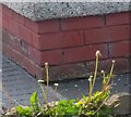
Ordnance Survey Cut Mark
This OS cut mark can be found on No37 Brahms Avenue. It marks a point 9.781m above mean sea level.
Image: © Adrian Dust
Taken: 4 May 2020
0.09 miles
2
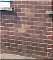
Ordnance Survey Cut Mark
This repositioned OS cut mark can be found on No232 Western Avenue. It marked a point 11.259m above mean sea level.
Image: © Adrian Dust
Taken: 4 May 2020
0.11 miles
3
Sandfields Methodist Church
Situated in Western Avenue SA12 7NF, this Methodist Church was opened on Friday 14th October 1966 to meet the needs of people who lived on the nearby Sandfields housing estate that had been built earlier in the 1950s. It is one of nine churches in the Neath Port Talbot Methodist Circuit.
Image: © David Hillas
Taken: 6 Mar 2023
0.14 miles
4
Information Board at Sandfields Methodist Church
This board is at the front of the Methodist Church in Western Avenue. It mentions that Sunday services are held at 10.30am and 6.00pm, although only morning services take place now. Also, it is stated on the board that other activities take place on Monday, Tuesday and Wednesday each week.
Image: © David Hillas
Taken: 6 Mar 2023
0.14 miles
5
Ordnance Survey Cut Mark
This OS cut mark can be found on Flat 44 St Helier Drive. It marks a point 10.872m above mean sea level.
Image: © Adrian Dust
Taken: 4 May 2020
0.17 miles
6
LloydsPharmacy, Sandfields
This pharmacy is located at 187 Western Avenue, SA12 7NE. Its future though is uncertain according to the dark green notice in its front window https://www.geograph.org.uk/photo/7430514 refers.
Image: © David Hillas
Taken: 6 Mar 2023
0.17 miles
7
Information Notice at LloydsPharmacy, Sandfields
This notice is on the front window of LloydsPharmacy in Western Avenue. It has the following wording:
This pharmacy is
undergoing a change
of ownership.
Services and opening
hours will continue
as normal during
this change.
LloydsPharmacy would like to
thank you for your loyal custom.
If you have any questions, please see our website
LloydsPharmacy.com
Image: © David Hillas
Taken: 6 Mar 2023
0.17 miles
8
Industrial estate on the edge of Sandfields
Looking north-east along Purcell Avenue.
Image: © Simon Mortimer
Taken: 9 Aug 2012
0.21 miles
9
Purcell Avenue
Image: © Colin Pyle
Taken: 30 Aug 2010
0.23 miles
10
BP Baglan Bay
Remnants of chemical works. (from SE)
Image: © Chris Shaw
Taken: Unknown
0.24 miles


