IMAGES TAKEN NEAR TO
Ynysymaerdy Road, NEATH, SA11 2TE
Introduction
This page details the photographs taken nearby to Ynysymaerdy Road, SA11 2TE by members of the Geograph project.
The Geograph project started in 2005 with the aim of publishing, organising and preserving representative images for every square kilometre of Great Britain, Ireland and the Isle of Man.

There are currently over 7.5m images from over14,400 individuals and you can help contribute to the project by visiting https://www.geograph.org.uk
Image Map
Images are licensed for reuse under creativecommons.org/licenses/by-sa/2.0
Notes
- Clicking on the map will re-center to the selected point.
- The higher the marker number, the further away the image location is from the centre of the postcode.
Image Listing (53 Images Found)
Images are licensed for reuse under creativecommons.org/licenses/by-sa/2.0
Image
Details
Distance
2
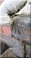
Ordnance Survey Rivet
This OS rivet can be found on the front of No24 Ynysmaerdy Road. It marks a point 13.579m above mean sea level.
Image: © Adrian Dust
Taken: 23 Aug 2016
0.06 miles
3
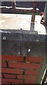
Ordnance Survey Rivet
This OS rivet can be found on the wall of the Sports Ground. It marks a point 10.775m above mean sea level.
Image: © Adrian Dust
Taken: 23 Aug 2016
0.06 miles
5
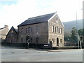
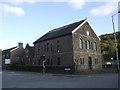
Y Graig chapel, Briton Ferry
Located on the corner of Ynysymaerdy Road and the A474. The date inscribed in stone is 1890 (located on the right, below the small twin windows near the top of the building).
Image: © Jaggery
Taken: 19 Feb 2011
0.08 miles
6
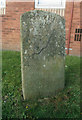
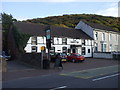
Old Milestone, A474, Neath Road, Briton Ferry
The milestone is located just south of the junction with Shelone Road/Ynysymaerdy Road. Relocated behind the new Lodge Court on the old Lodge Kinema site, on grass by bus stop, and almost below power lines, West side of road. Carved stone post, erected in the 19th century
Inscription reads:-
(Neath 2) : : (Aberavon 4) / BRITON FERRY
Milestone Society National ID: GLA_NTAA04
Image: © Ron Shackell
Taken: Unknown
0.09 miles
8
Middleton Street, Briton Ferry
From Rockingham Terrace along Middleton Street towards Neath Road.
Image: © Jaggery
Taken: 14 Feb 2024
0.11 miles
9
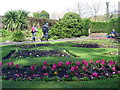
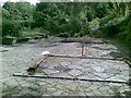
Parc Jersey Park
Parc Jersey yn Llansawel.
Jersey Park in Briton Ferry.
Image: © Alan Richards
Taken: 18 Mar 2007
0.11 miles
10
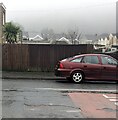
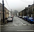
Into the mist, Briton Ferry
Looking to the ESE across Rockingham Terrace on a murky, drizzly day
in February 2024 when a tropical maritime air mass covers southern Britain.
On a clear day, a hillside view would be in the background.
Image: © Jaggery
Taken: 14 Feb 2024
0.12 miles