IMAGES TAKEN NEAR TO
Kenwood Park Road, SHEFFIELD, S7 1AA
Introduction
This page details the photographs taken nearby to Kenwood Park Road, S7 1AA by members of the Geograph project.
The Geograph project started in 2005 with the aim of publishing, organising and preserving representative images for every square kilometre of Great Britain, Ireland and the Isle of Man.

There are currently over 7.5m images from over14,400 individuals and you can help contribute to the project by visiting https://www.geograph.org.uk
Image Map
Images are licensed for reuse under creativecommons.org/licenses/by-sa/2.0
Notes
- Clicking on the map will re-center to the selected point.
- The higher the marker number, the further away the image location is from the centre of the postcode.
Image Listing (28 Images Found)
Images are licensed for reuse under creativecommons.org/licenses/by-sa/2.0
Image
Details
Distance
1
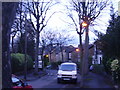
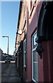
Wasteful street lighting
How many street lights are on when they make no contribution to safety or general wellbeing? This waste of energy should be stopped to help reach targets for lower carbon pollution. Not to mention our Council Tax bills!
Image: © Graham Cole
Taken: 9 Mar 2011
0.17 miles
2
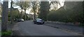
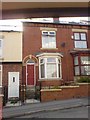
Crescent Road, Nether Edge, Sheffield
Image: © Mike Pennington
Taken: 22 Apr 2022
0.17 miles
3
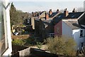
Nether Edge back gardens
The backs of houses on Steade Road, seen from an attic window on Alcester Road.
Image: © Christopher Hilton
Taken: 13 Apr 2010
0.19 miles
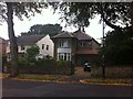
5
Typical housing of Sharrow.
This is Vincent Road.
Image: © Michael Hill-King
Taken: 23 Jul 2006
0.20 miles
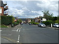
6
Terraced houses with satellite dishes
Sharrow Lane, Sheffield
Image: © Peter Barr
Taken: 30 Jan 2010
0.20 miles
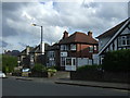
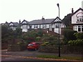
8
Rundle Road
Large houses in Nether Edge.
Image: © Burgess Von Thunen
Taken: 28 Sep 2013
0.20 miles
9
Rundle Road
1920s bungalows in Nether Edge.
Image: © Burgess Von Thunen
Taken: 28 Sep 2013
0.20 miles
10
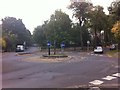
Nether Edge
At the junction of Crescent Road, Moncrieffe Road, Montgomery Road and Rundle Road.
Image: © Burgess Von Thunen
Taken: 28 Sep 2013
0.21 miles