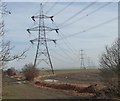
1
Hill Top Avenue
Image: © Alex McGregor
Taken: 10 Dec 2012
0.05 miles
2
Former colliery line, north of Greenset View
Closed in 1967, and now a public footpath.
Image: © Christine Johnstone
Taken: 16 Feb 2013
0.06 miles
3
Footpath
Old LNER railway track now a footpath.
Image: © John Douglas
Taken: 18 Nov 2006
0.09 miles
4
Pylon Near Athersley North
The UK national grid spans the country connecting power stations to the users. This particular pylon gives a slight change of direction to take the cables over the disused railway bridge on Wakefield Road near to the Eastfield Arms.
Image: © Martin Lee
Taken: Unknown
0.10 miles
5
Pylons heading east, near Athersley North
Seen from the former railway line.
Image: © Christine Johnstone
Taken: 16 Feb 2013
0.10 miles
6
Former railway junction, Athersley North
The left [northbound] line closed to passengers in 1930, and to freight in 1961. It is now part of the Royston and Carlton boundary walk. The right [eastbound] line went to a colliery, and closed in 1967. Both are now public footpaths.
Image: © Christine Johnstone
Taken: 16 Feb 2013
0.10 miles
7
Heading south to Barnsley, below Hill Top Avenue
This line closed to passengers in 1930, and to freight in 1967. It is now part of the Royston and Carlton boundary walk, and a public footpath.
Image: © Christine Johnstone
Taken: 16 Feb 2013
0.11 miles
8
Heading towards Royston
This former railway line closed to passengers in 1930, and to freight in 1961. It is now part of the Royston and Carlton boundary walk.
Image: © Christine Johnstone
Taken: 16 Feb 2013
0.12 miles
9
Trees along a field boundary, near Athersley North
Seen from the former railway line.
Image: © Christine Johnstone
Taken: 16 Feb 2013
0.14 miles
10
The pylons change direction
Collieries meant power stations, power stations mean pylons everywhere.
Image: © Christine Johnstone
Taken: 9 Feb 2011
0.15 miles


