
IMAGES TAKEN NEAR TO
Stanwood Drive, SHEFFIELD, S6 5HZ
Introduction
This page details the photographs taken nearby to Stanwood Drive, S6 5HZ by members of the Geograph project.
The Geograph project started in 2005 with the aim of publishing, organising and preserving representative images for every square kilometre of Great Britain, Ireland and the Isle of Man.

There are currently over 7.5m images from over14,400 individuals and you can help contribute to the project by visiting https://www.geograph.org.uk
Image Map
Images are licensed for reuse under creativecommons.org/licenses/by-sa/2.0
Notes
- Clicking on the map will re-center to the selected point.
- The higher the marker number, the further away the image location is from the centre of the postcode.
Image Listing (38 Images Found)
Images are licensed for reuse under creativecommons.org/licenses/by-sa/2.0
Image
Details
Distance
2
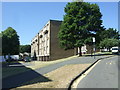
Flats & Suburban estate in West Sheffield
One of the many estates of NW Sheffield
Image: © N Chadwick
Taken: 13 May 2006
0.03 miles
3
Stanwood Methodist Church, Stannington, Sheffield
A view of Stanwood Methodist Church at the junction of Stannington Road (the B6076) and Stanwood Road. A pedestrian can be seen on Stanwood Road. This church, which cost approximately £33,000 to build in the early 70s, superseded the Primitive Methodist establishment known as Woodland View Chapel (1860-1972) that was situated near the junction of Stannington Road and Wood Lane. Before this new church was built a row of prefabricated bungalows existed along the length of Stanwood Road.
Image: © David Hallam-Jones
Taken: 18 Feb 2018
0.04 miles
7
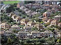
Hollins Lane, Stannington
The lane extends from Rivelin Valley Road to Stannington Road. Centre of frame is it at its junction with Rivelin Park Crescent.
Image: © Dave Hitchborne
Taken: 26 Aug 2008
0.11 miles
8
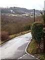
Roscoe Bank, Stannington, Sheffield
The former Bell Hagg Inn, that closed in 2005, can be seen on the northern side of the A57 (the main Sheffield -Manchester Road), near Crosspool. It finally closed in 2005 and has now been converted into a seven-bedroom family home. It is believed that the original building was erected in 1832 as a five-storey house for a certain Dr Hodgeson who had built it as a folly to antagonise the Vicar of Stannington after the incumbent turned down the offer of a generous donation from him because Hodgeson had made much of his fortune from gambling. Before becoming a pub the building was used as a tea room by workers associated with a former quarry opposite it (that is now occupied by the Valleyside Garden Centre), and also by travellers between these two northern cities.
Image: © David Hallam-Jones
Taken: 18 Feb 2018
0.13 miles
10
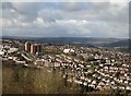
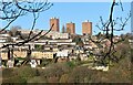
Stannington seen from Crookes
The viewpoint was Woodfield Road above Bole Hill Park. The three housing blocks to the left are Deer Park Flats.
Image: © Neil Theasby
Taken: 24 Feb 2017
0.15 miles