IMAGES TAKEN NEAR TO
Church Street, ROTHERHAM, S61 4EL
Introduction
This page details the photographs taken nearby to Church Street, S61 4EL by members of the Geograph project.
The Geograph project started in 2005 with the aim of publishing, organising and preserving representative images for every square kilometre of Great Britain, Ireland and the Isle of Man.

There are currently over 7.5m images from over14,400 individuals and you can help contribute to the project by visiting https://www.geograph.org.uk
Image Map
Images are licensed for reuse under creativecommons.org/licenses/by-sa/2.0
Notes
- Clicking on the map will re-center to the selected point.
- The higher the marker number, the further away the image location is from the centre of the postcode.
Image Listing (18 Images Found)
Images are licensed for reuse under creativecommons.org/licenses/by-sa/2.0
Image
Details
Distance
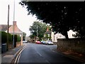
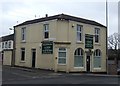
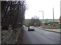
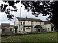
3
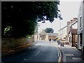
Church Street in Greasbrough
The Yellow Lion Public House can be seen on the right of picture.
Image: © Jonathan Clitheroe
Taken: 10 Aug 2016
0.08 miles
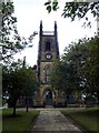
9
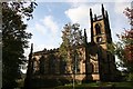
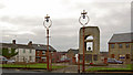
St.Mary's church, Greasbrough
By Charles Watson and J.P.Pritchett in 1826
Image: © Richard Croft
Taken: 23 Oct 2006
0.10 miles