IMAGES TAKEN NEAR TO
Reneville Road, ROTHERHAM, S60 2AN

Introduction

This page details the photographs taken nearby to Reneville Road, S60 2AN by members of the Geograph project.

The Geograph project started in 2005 with the aim of publishing, organising and preserving representative images for every square kilometre of Great Britain, Ireland and the Isle of Man.

There are currently over 7.5m images from over14,400 individuals and you can help contribute to the project by visiting https://www.geograph.org.uk

Image Map


Images are licensed for reuse under creativecommons.org/licenses/by-sa/2.0
Notes
  • Clicking on the map will re-center to the selected point.
  • The higher the marker number, the further away the image location is from the centre of the postcode.

Image Listing (40 Images Found)

Images are licensed for reuse under creativecommons.org/licenses/by-sa/2.0
  • ...
Image
Details
Distance
1
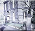
Victorian House, Mountenoy Road
This stone built house had been divided into two flats in the 1960s. It looks out over the Don Valley and the steel works to views of the Derbyshire Moors the far side of Sheffield.
Image: © Alan Hawkes Taken: 10 Sep 1970
0.05 miles
2
The old chapel in Moorgate cemetery
Totally run down, windows smashed and boarded up ... a sad sight.
Image: © steven ruffles Taken: 16 Jun 2015
0.13 miles
3
The old chapel in Moorgate Cemetery, Rotherham
Erected in the mid nineteenth century when the dead of Rotherham were no longer permitted in the old graveyard that once surrounded the parish church. This has been said of the chapel - "At the bottom of a gentle slope a chapel was erected, described as having small paned Romanesque windows, cruciform finials and square spikelets. The chapel had an entrance at each end and a central partition which enabled use by both Anglicans and Nonconformists. Nonconformists entered the chapel by the front entrance and the Anglicans by the rear entrance."
Image: © Neil Theasby Taken: 17 Aug 2014
0.13 miles
4
Moorgate Hall
Image: © John Slater Taken: 22 Oct 2014
0.13 miles
5
Moorgate Cemetery and Chapel
The cemetery opened in 1841 and contains the resting places of many of the town's iron and steel barons.
Image: © Graham Hogg Taken: 10 Apr 2013
0.13 miles
6
The bottom of Moorgate Cemetery
From here there is a fine view out over the Rother and Don valleys. The Rank Hovis flour mill is the dominant building.
Image: © Alan Murray-Rust Taken: 11 May 2008
0.13 miles
7
Don and Rother Valley panorama ( part 1)
Looking NNW with Rotherham centre to the right; the dark spire of the parish church is just discernible. The yellow rape fields are Barbot Hill behind which lies Greasbrough. The Canklow Road estate is just in view bottom left with the large Rank Hovis mill behind. This is one of seven pictures used to create the panorama pictureImage
Image: © Alan Murray-Rust Taken: 11 May 2008
0.14 miles
8
Rother View Road
The Magic map shows a continuous row of houses on this side of the road as well, possibly in the same style as those visible, but they have disappeared without trace. They have already disappeared too from the 1:25000 and 1:50000 maps.
Image: © Alan Murray-Rust Taken: 11 May 2008
0.14 miles
9
Broom in bloom
Looking north along the hillside above Canklow Road
Image: © Alan Murray-Rust Taken: 11 May 2008
0.14 miles
10
Moorgate Cemetery
Image: © John Slater Taken: 22 Oct 2014
0.14 miles
  • ...