
IMAGES TAKEN NEAR TO
Retail World, Little Bridge Road, ROTHERHAM, S60 1TU
Introduction
This page details the photographs taken nearby to Retail World, Little Bridge Road, S60 1TU by members of the Geograph project.
The Geograph project started in 2005 with the aim of publishing, organising and preserving representative images for every square kilometre of Great Britain, Ireland and the Isle of Man.

There are currently over 7.5m images from over14,400 individuals and you can help contribute to the project by visiting https://www.geograph.org.uk
Image Map
Images are licensed for reuse under creativecommons.org/licenses/by-sa/2.0
Notes
- Clicking on the map will re-center to the selected point.
- The higher the marker number, the further away the image location is from the centre of the postcode.
Image Listing (34 Images Found)
Images are licensed for reuse under creativecommons.org/licenses/by-sa/2.0
Image
Details
Distance
1
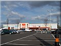
Yes ... There is a B&Q in Rotherham!
A brand new B&Q has opened in the Parkgate area ... replacing that near to the ring road. Image
Image: © Terry Robinson
Taken: 28 Oct 2009
0.03 miles
2
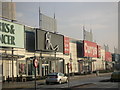
Retail World
This is Retail World Shopping Centre at Parkgate.
It was built on the site of a former slag reduction works.
Image: © Christopher Thomas
Taken: 23 Sep 2005
0.07 miles
4
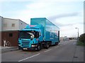
Argos Delivery, Parkgate, Rotherham
Loads-a-Christmas Goodies no doubt!
Image: © Terry Robinson
Taken: 28 Oct 2009
0.12 miles
5
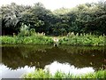
Pair of Swans by Earl Fitzwilliam's Canal
Image: © Jonathan Clitheroe
Taken: 13 Aug 2016
0.13 miles
6
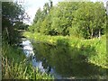
Earl Fitzwilliam's Canal
Earl Fitzwilliam's Canal, or the Fitzwilliam Canal as it is sometimes called is a half mile long spur off of the Rotherham Cut. Navigable access to the Rotherham Cut is now blocked by an embankment supporting the A633, although a pipe still connects the two waterways.
Image: © Martin Speck
Taken: 9 Aug 2009
0.13 miles
7
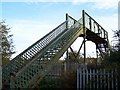
Railway Footbridge - 2, Parkgate, Rotherham
Image: © Terry Robinson
Taken: 28 Oct 2009
0.15 miles
8
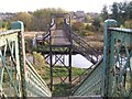
Canal Footbridge, Parkgate, Rotherham
Viewed from the Railway Footbridge ... the two bridges form a continuous public footpath over two man made obstacles. The Eastwood area of Rotherham is in the distance ... no doubt the footpath leads there - eventually. Image Image Image Image
Image: © Terry Robinson
Taken: 28 Oct 2009
0.15 miles
9
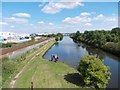
Children fishing on the Rotherham Cut
The Rotherham Cut was dug in the early nineteenth century to bypass the River Don and so enable the freer movement of industrial barge traffic.
Image: © Neil Theasby
Taken: 16 Aug 2013
0.16 miles
10
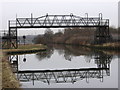
Rotherham - Eastwood Footbridge
This footbridge over the Don Navigation carries a path that links the Eastwood and Parkgate areas of Rotherham. To the south is a Bayley bridge crossing of the River Don (see Image) and Eastwood. To the north is a crossing of the Rotherham to Swinton railway line (see Image) and Parkgate.
Eastwood Footbridge is shown as “swing bridge” on the 2000 edition of the OS Explorer map - the existence of a swing bridge at this point is borne out by the “constriction” in the Navigation visible in the photograph.
The public footpath over Eastwood Footbridge is a good example of how a right of way has been maintained in spite of natural and man-made obstacles:
* Firstly, there must have been a man-made crossing of the River Don which linked Park Gate in the north with Eastwood in the south.
* When the Don Navigation (Rotherham Cut) was constructed in 1740 (see http://en.wikipedia.org/wiki/River_Don_Navigation ), a swing bridge (now a footbridge) was provided to maintain the right of way.
* When the MS&L railway was constructed in 1868 (see http://en.wikipedia.org/wiki/Rotherham_Central_railway_station ), a crossing was provided (now a footbridge).
* In the 1990’s, when the Parkgate Retail Park was constructed, a narrow pedestrian gap was provided in what would otherwise have been a continuous 600m row of retail units in order to preserve the right of way.
* However, this is no longer a pedestrian-friendly route – there are 96 steps on the 2 footbridges and a walker has to brave the crossing of the many car parks and service roads in the Retail Park.
* PS (Feb 2014): The footbridge has been closed, but will be replaced (see https://canalrivertrust.org.uk/notice/512/eastwood-footbridge for details).
Image: © Dave Bevis
Taken: 17 Jan 2011
0.16 miles