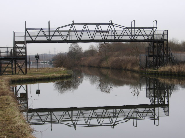
Rotherham - Eastwood Footbridge
Introduction
The photograph on this page of Rotherham - Eastwood Footbridge by Dave Bevis as part of the Geograph project.
The Geograph project started in 2005 with the aim of publishing, organising and preserving representative images for every square kilometre of Great Britain, Ireland and the Isle of Man.
There are currently over 7.5m images from over 14,400 individuals and you can help contribute to the project by visiting https://www.geograph.org.uk

Image: © Dave Bevis Taken: 17 Jan 2011
This footbridge over the Don Navigation carries a path that links the Eastwood and Parkgate areas of Rotherham. To the south is a Bayley bridge crossing of the River Don (see Image) and Eastwood. To the north is a crossing of the Rotherham to Swinton railway line (see Image) and Parkgate. Eastwood Footbridge is shown as “swing bridge” on the 2000 edition of the OS Explorer map - the existence of a swing bridge at this point is borne out by the “constriction” in the Navigation visible in the photograph. The public footpath over Eastwood Footbridge is a good example of how a right of way has been maintained in spite of natural and man-made obstacles: * Firstly, there must have been a man-made crossing of the River Don which linked Park Gate in the north with Eastwood in the south. * When the Don Navigation (Rotherham Cut) was constructed in 1740 (see http://en.wikipedia.org/wiki/River_Don_Navigation ), a swing bridge (now a footbridge) was provided to maintain the right of way. * When the MS&L railway was constructed in 1868 (see http://en.wikipedia.org/wiki/Rotherham_Central_railway_station ), a crossing was provided (now a footbridge). * In the 1990’s, when the Parkgate Retail Park was constructed, a narrow pedestrian gap was provided in what would otherwise have been a continuous 600m row of retail units in order to preserve the right of way. * However, this is no longer a pedestrian-friendly route – there are 96 steps on the 2 footbridges and a walker has to brave the crossing of the many car parks and service roads in the Retail Park. * PS (Feb 2014): The footbridge has been closed, but will be replaced (see https://canalrivertrust.org.uk/notice/512/eastwood-footbridge for details).

