IMAGES TAKEN NEAR TO
Sheffield Road, CHESTERFIELD, S41 9EJ

Introduction

This page details the photographs taken nearby to Sheffield Road, S41 9EJ by members of the Geograph project.

The Geograph project started in 2005 with the aim of publishing, organising and preserving representative images for every square kilometre of Great Britain, Ireland and the Isle of Man.

There are currently over 7.5m images from over14,400 individuals and you can help contribute to the project by visiting https://www.geograph.org.uk

Image Map


Images are licensed for reuse under creativecommons.org/licenses/by-sa/2.0
Notes
  • Clicking on the map will re-center to the selected point.
  • The higher the marker number, the further away the image location is from the centre of the postcode.

Image Listing (10 Images Found)

Images are licensed for reuse under creativecommons.org/licenses/by-sa/2.0
Image
Details
Distance
1
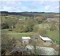
Equestrian paddock
Image: © N Chadwick Taken: 29 Oct 2014
0.07 miles
2
Farmland near Unstone Green
Image: © JThomas Taken: 18 Apr 2013
0.10 miles
3
View from the railway line
Image: © N Chadwick Taken: 29 Oct 2014
0.14 miles
4
Pasture at Unstone
Submitted to the BBC Domesday Reloaded project. Looking west from Unstone Road across the railway and Sheffield Road to former NCB opencast coal site, Birch Hall. Some of the land on the far side of the valley is now a golf course. The 1986 picture has the location of the photographer as Old Whitington Lane, when it was, in fact, taken from Unstone Road. Image
Image: © Martin Speck Taken: 1 Jul 2011
0.18 miles
5
Horse & Jockey
Public House on the outskirts of Unstone Green
Image: © Roger Temple Taken: 22 Oct 2006
0.18 miles
6
Horse and Jockey Public House in Unstone Green
Unstone Green was a purpose-built community that sprang up in the 1940s to serve the mining industry. This pub in turn sprang up to serve the miners.
Image: © Jonathan Clitheroe Taken: 7 May 2011
0.21 miles
7
"The Horse and Jockey" at Unstone Green
Image: © Neil Theasby Taken: 6 Mar 2012
0.21 miles
8
Near Ramshaw Farm
Image: © N Chadwick Taken: 29 Oct 2014
0.22 miles
9
The Sandpiper Hotel
The rooms spread out before us as we look towards the Sheffield Road.
Image: © Malcolm Neal Taken: 5 Jun 2019
0.24 miles
10
Unstone Green
Housing at Unstone Green, seen from a train on the railway line between Chesterfield and Dronfield. The pub shown in Image is partly obscured by trees right of centre. The row of houses to its left is on Cheetham Avenue. The pub, and the detached houses to the left of the image, are along the B6057 Sheffield Road, running roughly parallel to the railway down the Drone valley; the river runs in the foreground. Behind rises Monk Wood.
Image: © Derek Harper Taken: 6 Apr 2012
0.24 miles