Unstone Green
Introduction
The photograph on this page of Unstone Green by Derek Harper as part of the Geograph project.
The Geograph project started in 2005 with the aim of publishing, organising and preserving representative images for every square kilometre of Great Britain, Ireland and the Isle of Man.

There are currently over 7.5m images from over 14,400 individuals and you can help contribute to the project by visiting https://www.geograph.org.uk
Unstone Green
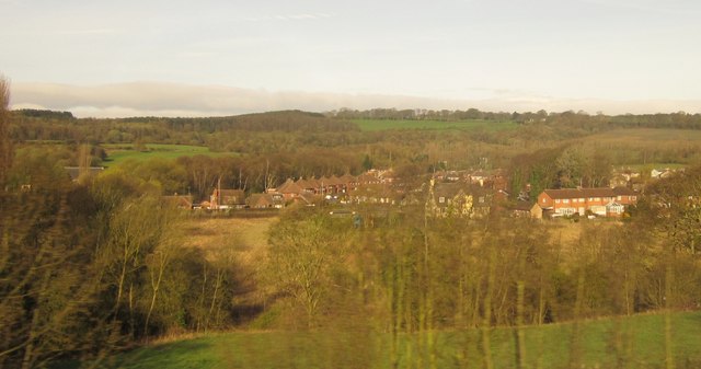
Image: © Derek Harper Taken: 6 Apr 2012
Housing at Unstone Green, seen from a train on the railway line between Chesterfield and Dronfield. The pub shown in Image is partly obscured by trees right of centre. The row of houses to its left is on Cheetham Avenue. The pub, and the detached houses to the left of the image, are along the B6057 Sheffield Road, running roughly parallel to the railway down the Drone valley; the river runs in the foreground. Behind rises Monk Wood.
Images are licensed for reuse under creativecommons.org/licenses/by-sa/2.0
Image Location
Latitude
53.282369
Longitude
-1.442017