
IMAGES TAKEN NEAR TO
Royd Lane, SHEFFIELD, S36 9NY
Introduction
This page details the photographs taken nearby to Royd Lane, S36 9NY by members of the Geograph project.
The Geograph project started in 2005 with the aim of publishing, organising and preserving representative images for every square kilometre of Great Britain, Ireland and the Isle of Man.

There are currently over 7.5m images from over14,400 individuals and you can help contribute to the project by visiting https://www.geograph.org.uk
Image Map
Images are licensed for reuse under creativecommons.org/licenses/by-sa/2.0
Notes
- Clicking on the map will re-center to the selected point.
- The higher the marker number, the further away the image location is from the centre of the postcode.
Image Listing (14 Images Found)
Images are licensed for reuse under creativecommons.org/licenses/by-sa/2.0
Image
Details
Distance
1
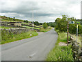
Royd Lane, Thurlstone
The building on the left is a sewage pumping station, according to the large-scale OS map. The footpath on the right leads to Millhouse Green.
Image: © Humphrey Bolton
Taken: 10 Jul 2020
0.04 miles
2
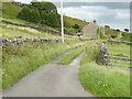
Slant Gate, off Royd Lane, Thurlstone
This is a public footpath on a track up to High Bank Lane.
Image: © Humphrey Bolton
Taken: 10 Jul 2020
0.10 miles
3
Water trough, Royd Lane, Thurlstone
Image: © Humphrey Bolton
Taken: 10 Jul 2020
0.12 miles
5
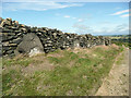
Orthostats in a drystone wall, Thurlstone
These are alongside High Ban Lane. The boulders are unlikely to have been there, neatly in a row, before the wall was built alongside the lane, but were presumably moved into position when the moorland was cleared to make a field.
Image: © Humphrey Bolton
Taken: 16 Jul 2020
0.13 miles
6
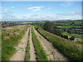
High Bank Lane, Thurlstone
This is a road that somehow avoided being surfaced. It is along the edge of Thurlstone Bank, and there are splendid views.
Image: © Humphrey Bolton
Taken: 16 Jul 2020
0.13 miles
7
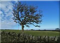
Thorn tree by High Bank Lane
North of Millhouse Green
Image: © Neil Theasby
Taken: 17 Mar 2021
0.15 miles
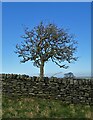
9
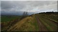
Footpath along High bank.
Looking back whilst walking to Thurlstone.
Image: © steven ruffles
Taken: 20 Nov 2012
0.17 miles
10
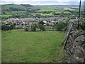
Towards Millhouse Green from High Bank Lane
Image: © Chris Wimbush
Taken: 18 Jun 2011
0.19 miles